< 630 to 639 | Home | 650 to 659 >
| SC 640 not currently assigned | ||||||||||||
| Previous SC 640's: |
SC 640: Appeared in 1939 as new primary routing. Ran from SC 64 (current US 17 ALT) east of Walterboro northeast to SC 65 (current SC 61) near the Koger Tomb.
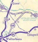
In 1941 or 1942, SC 640 was extended north across the Edisto River to end at SC 173 (current S-18-30). 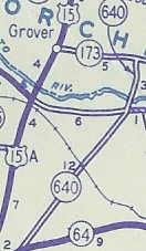
In 1948, all 15 miles of SC 640 were downgraded to S-15-21 and S-18-29. |
|||||||||||
|
|
|
| ROUTE LOG |
US 301: 0 - 0 US 321: 4.2 - 4.2 Bamberg-Allendale Line: 7.6 - 11.8 Colleton-Bamberg Line: 2.2 - 14 US 601: 1.4 - 15.4 SC 64: 6 - 21.4
|
Creation: Appeared in 1931 or 1932 as new routing. Only ran from SC 64 west to SC 36 (current US 601)
| Adjustments: In 1937 or 1938, SC 641 was extended west as new routing to SC 33-331 (current US 321) Sycamore. 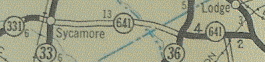
In 1942, SC 641 was given a straighter alignment between Sycamore and Colleton County, leaving behind a secondary road (S-5-8 today) and SC 330 (S-5-31 and S-15-37 today). Note that the Sycamore to SC 36 (current US 601) distance has dropped from 13 to 11. 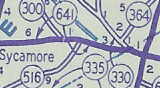
In 1947 or 1948, SC 641 was extended west to Allendale, replacing a piece of SC 73. SC 641 was extended further west to the south boundary of the Savannah River Plant (replacing part of SC 28) in 1953. This made SC 641 44 miles long. SC 641 west was truncated back to US 301 between 1968-70, replaced by SC 125. Between 1948-70 it may not have been possible to travel through the Savannah River Plant. Improvements: Fully paved on the 1932 map; Extensions weren't paved until 1942. No multilane sections. Comment: SC 641 makes an empty but fine short cut to travel from Augusta to Charleston via SC 125-641-64.... |
|||||
|
|
|
| ROUTE LOG |
US 17 ALT: 0 - 0 SC 165: 2.9 - 2.9 Charleston-Dorchester Line: 8 - 10.9 I-526 (exit 15): 5.1 - 16 I-26 (exit 215): 1.9 - 17.9 US 52, US 78: 0.8 - 18.7
|
Creation: Appeared in 1939 as new routing. Originally was a spur off SC 64 (current US 17 ALT) Knightsville running north to US 78/SC 2 Jedburg.
| 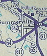
Adjustments: In 1940, SC 642 was extended north as new routing to end at SC 6 (current S-8-5) near Pinopolis. 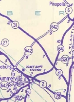
In 1941 or 1942, SC 642 was extended south to Dorchester Rd, then east to US 52, US 78 as today, all as new routing. This made SC 642 41 miles long! 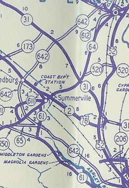
In 1948, SC 642 was placed on the entirety of Dorchester Rd. below SC 61 (current SC 165) The route to Knightsville, Jedburg, and Pinopolis became S-18-22 and S-8-16. The piece between SC 61 and today's S-18-22 was still part of SC 65. SC 642 ws extended over SC 65 back out to US 17 ALT in 1951 or 1952. Improvements: SC 642's current alignment was shown as mostly not paved up through 1953. SC 642 was 4-laned out to Ashley Phosphate Rd. (S-18-62) by the mid-70's. This 4-laning was extended out to Oakbrook (S-18-199) in the early 1990's. Comment: SC 642 serves the Charleston AFB. |
|||||
| SC 643 not currently assigned | |||
| Previous SC 643's: |
SC 643: Appeared in 1940 as new primary routing. Ran from SC 641 (current S-5-31) Rivers Bridge State Park north to SC 334 (current S-5-23), a total of 9 miles.
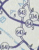
In 1942, SC 643 south was truncated 1 mile by the creation of SC 330. 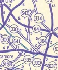
In 1948, SC 643 was downgraded to S-5-19. |
||
| SC 644 not currently assigned | |||
| Previous SC 644's: |
SC 644: Appeared in 1940 as new primary routing. Ran from SC 64 just east of today's I-95 northwest to US 21 near Smoaks.
The 14 miles of SC 644 were downgraded in 1948 to S-15-24. | 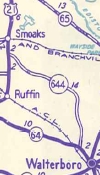 |
|
| SC 645 not currently assigned | |||
| Previous SC 645's: |
SC 645: Appeared in 1940 as new primary routing, running as a 2 mile stub west off SC 64 in Willow Swamp.
In 1941 or 1942, SC 645 was extended south to SC 63 for a grand total of 7 miles. 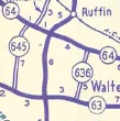
In 1948, SC 645 was downgraded to S-15-27 and S-27-31. |
||
| SC 646 not currently assigned | |||
| Previous SC 646's: |
SC 646: Appeared in 1941 or 1942 as new primary routing. Ran from SC 64 (current SRS Route B) west of Dunbarton south to SC 28 (current SC 125) near the Barwell-Allendale Line, a 6 mile stretch.
In 1948, SC 646 was downgraded to a secondary road. SC 646's route is totally within the boundary of the Savannah River Site today, and appears to be SRS Route 9. | 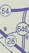 |
|
| SC 647 not currently assigned | |||
| Previous SC 647's: |
SC 647: Appeared in 1941 or 1942 as new primary routing. Ran from the SC 28-64 split (current SC 125-SRS Route B split) southwest 2 miles.
SC 647 was downgraded to secondary status in 1948 and today is inside the Savannah River Site. |  |
|
| SC 648 not currently assigned | |||
| Previous SC 648's: |
SC 648: Appeared in 1941 or 1942 as new primary routing. Ran from SC 64 (current SRS Route B) Dunbarton northwest 4 miles.
In 1948, SC 648 was downgraded to secondary status and today may be part of SRS Route F. | 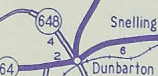 |
|
| SC 649 not currently assigned | |||
| Previous SC 649's: |
SC 649: Appeared in 1941 or 1942 as new primary routing. Ran from the Savannah River through Ellenton, across SC 28 (current SC 125) and east to the Barnwell County Line.
The 5 miles of SC 649 were downgraded to secondary status in 1948. Today SC 649 is part of SRS Route 3. | 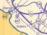 |
|
Last Update: 30 May 2005
Previous: SC 630 - 639 |
Next: SC 650 - 659
Top | South Carolina Hwy Index
Home