< SC 260 | Home | SC 262 >
|
|
|
| ROUTE LOG |
US 521: 0 - 0 Sumter-Kershaw Line: 6.3 - 6.3 US 76, US 378: 11.8 - 18.1 SC 763: 3.9 - 22 SC 120: 12.5 - 34.5 Clarendon-Sumter Line: 3.9 - 38.4 US 15: 2.4 - 40.8 I-95 (exit 119): 7.1 - 47.9 SC 260: 2.0 - 49.9 US 301: 0.1 - 50.0 US 521 NB: 0.1 - 50.1 US 521 SB: 3.0 - 53.1 Williamsburg-Clarendon Line: 9.6 - 62.7 US 52 EB: 8.7 - 71.4 US 52 WB, SC 527: 2.4 - 73.8 SC 377: 0.7 - 74.5 SC 512 WB: 14.5 - 89 SC 512 EB: 2.3 - 91.3 SC 41, SC 51: 6.9 - 98.2 Georgetown-Williamsburg Line: 5.0 - 103.2 SC 513: 5.2 - 108.4 US 701: 9.0 - 117.4
|
Creation: SC 261 appeared in 1923 as new primary routing, running from SC 26 (now SC 261) several miles east of Wilson southeast through Greeleyville to end at SC 41-44 (now SC 375-377 jct) Gourdin. This is the only SC 261.
| Adjustments: About 1925, SC 261 east was truncated to a relocated SC 41 (now US 52/SC 375 jct) west of Gourdin. The route east to Gourdin became part of an extended SC 44, although it appears SC 44 may have run dirctly to Lane on today's S-45-385. In 1928, SC 261 was extended east to Gourdin, then north through Lane to end at SC 26 (now US 521/SC 377 jct). This was a replacement for SC 44.
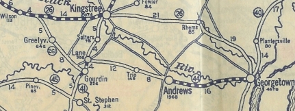
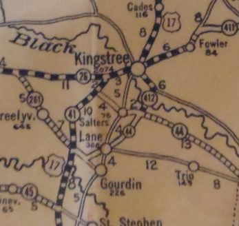
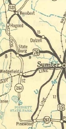
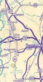
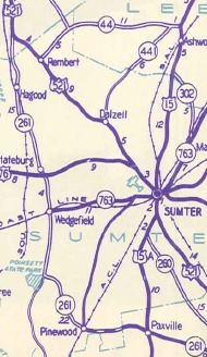
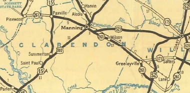
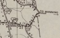
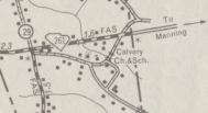
In 1931, SC 261 west was rerouted at Greeleyville to run into SC 26 very close to Wilson. The old route north of Greeleyville became part of SC 171. Today it is S-45-27, S-45-35, and unnumbered dirt road Bennett Branch Rd. In May 1936 (SCDOT), SC 261 was assigned to a new primary route from US 15 Paxville west to the Sumter County Line. In July 1936 (SCDOT) SC 261 was extended west with US 521 to Manning, then west as new primary routing to Paxville. In Nov 1937 (SCDOT), a second piece of SC 261 was created as new primary routing from US 76 Stateburg south to Poinsett State Park. In 1939, the second piece of SC 261 was extended noth as new primary routing to end at US 521 (now S-28-2) north of Rembert. In 1940, the two pieces of SC 261 were connected.
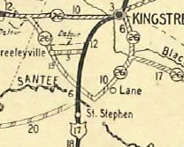
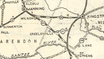
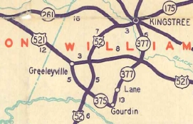
In 1947, SC 261 west was truncated to US 76, leaving behind S-28-11 and S-43-19. US 76 to Stateburg became part of SC 441. In 1949, SC 261 was rerouted east of Manning, replacing US 521 to US 52 near Kingstree. Wilson to Greeleyville became part of US 521. Greeleyville to Gourdin became SC 375 and Gourdin north to US 521 became SC 377.
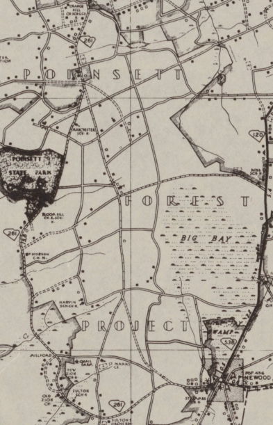
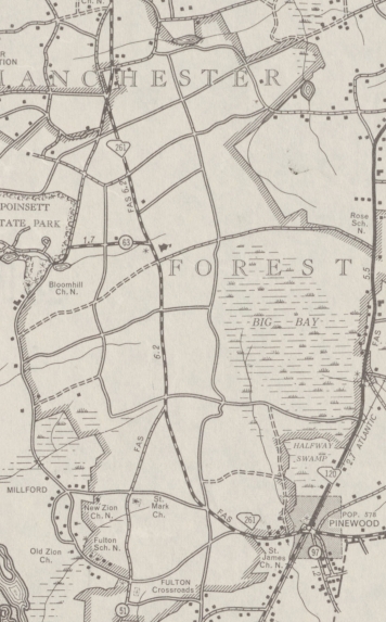
Also in 1949, SC 261 was rerouted in several places between Paxville and Wedgefield. The new 261 was on existing secondary routes west of Pinewood and on new construction from Pinewood to Paxville. The old route is now Keels Rd west of Paxville; S-43-535 Sammy Swamp Rd; Calvary Church Rd. Within Pinewood, SC 261 used to use S-43-288 Fulton St loop north of Clark; S-43-621 Clark St through central Pinewood; S-43-295 Sumter St south to Fulton. S-43-808 through Fulton Crossroads to Mill Creek State Park; Milford Plantation Rd to Poinstt State Park; River Rd and Old Charleston Rds
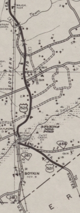
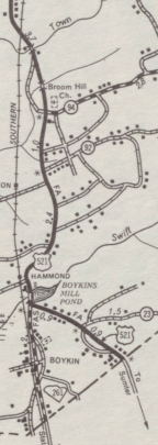
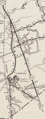
In 1950, SC 261 was re-extended north from US 76 to US 521. In the Boykin area SC 261 was placed on new construction to stay east of the railroad the entire way.
In 1952, SC 261 was extended east with US 52 to Kingstree, then replaced SC 175 to end at SC 41-51 Hemingway. In 1960, SC 261 was extended east to US 701 Yauhannah replacing parts of SC 51 and SC 513.
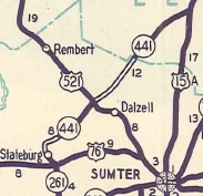
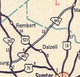
In 1961, SC 261 west was extended north to its current end south of Camden, replacing part of US 521.
Improvements: SC 261 was paved from the US 52/SC 375 jct northwest to US 521 in 1932. SC 261 was paved from Paxville to Manning in 1937. SC 261 was paved from Lane northward in 1938. SC 261 was paved from Paxville to the Sumter line in 1939. SC 261 was paved from Lane southwest to US 52 in 1940. SC 261 was paved from Pinewood east to the Clarendon line in 1941. By 1948, SC 261 was paved from Poinsett S.P. north to US 76. In 1949, SC 261 was paved from Poinsett S.P. to Pinewood. All extensions of SC 261 were paved upon designation after this. SC 261 only has 2 multilane segments: US 52 duplex which was multilaned east of the Black River by 1975 and west of the Black River in 2000. I-95 to Manning which is not shown on maps but has been that way back to at least the mid 1990s. Comment: SC 261 is one of the longer 3-digit routes in South Carolina. SC 261 serves Poinsett State Park. | ||||||||||||||||||||||||


Previous: SC 260 |
Next: SC 262
Top | South Carolina Hwy Index
Home
Page last modified 1 August 2015