< VA 434 | Home | VA 436 >
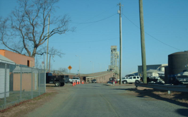
Photo: This is the Marina access road (old VA 435) approaching the old ferry landing (photo by Mapmikey, January 2008)
| VA 435 not currently assigned | ||||
| Previous VA 435's: 1932 ROUTE LOG VA 407: 0 - 0 S. FERRY LDG: 1.95 - 1.95 N. FERRY LDG: 0 - 1.95 VA 41: 1.10 - 3.05 |
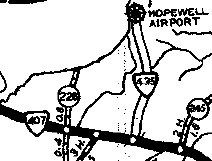
VA 435: Appeared in Dec 1930 (CTB) as new primary routing, running from VA 407 (now VA 10) to the Hopewell Airport
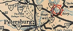
In July 1932 (CTB), VA 435 was extended north to the James River where a ferry crossed to Charles City County, then more VA 435 was created as new routing from the river to VA 41 (now VA 5). This is not shown on any map. In July 1933, VA 435 became part of VA 36. Today it is VA 106-156 south of the river plus the marina access road just below the bridge, and SR 658 north of the river.
|
|||
Previous: VA 434 |
Next: VA 436
Top | Virginia Hwy Index
Home
Page last modified 13 December 2023