Official Maps 1938-41 showing US 33 entering Richmond with US 250
1938-39 Official
Official Maps 1944-46 not showing US 33 at all in Richmond
1944 Official
Official Maps 1947-61 not showing much more
1947 Official
US 33/VA 33 Transition (1930s-40s)
Official State Maps
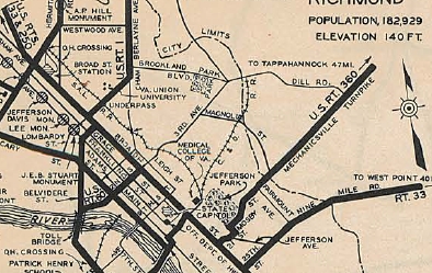
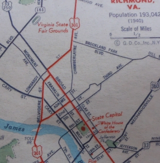
Virginia official state map insets still only showed route numbers mostly at the edges of the inset. So the July 1938 Official does show US 33-250 entering from the west, that is to say that on paper, US 33 did follow US 250 into Richmond. Broad St is shown as primary (VA did not differentiate colors for US routes until 1947) all the way through Richmond. US 1 has a brief overlay. US 60 met Broad St from 2nd St. So it is clear that US 250 ended at US 60, 2nd at Broad. So I presume US 33 ended there as well.
The first Virginia official map to label routes on insets with shields everywhere was the 1944 issue. It shows a VA 33 shield on Broad between Staples Mill and VA 161. However, this can't be trusted because it also shows Staples Mill Rd as VA 33. There are no other 33 shields on Broad. The 1946 Official repeats these errors.
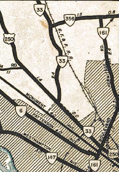
The 1947 Official shows US 33 on Broad west of VA 161, as well as on Staples Mill, and shows VA 33 on 25th/Nine Mile Rd. There are no other shields on Broad. This is shown on every issue through 1959.
|
Official Maps 1938-41 showing US 33 entering Richmond with US 250 1938-39 Official |
Official Maps 1944-46 not showing US 33 at all in Richmond 1944 Official |
Official Maps 1947-61 not showing much more 1947 Official |
VDOT County Maps:
The earliest Henrico County map I have after US 33's birth is from 1945. It explicitly shows US 250 on Broad between US 1 and US 60, but shows neither US 33 nor VA 33 on any part of Broad. This is true through 1957.
Other Maps:
General Drafting maps up through at least 1948 did not label any route numbers on Broad St between VA 161 and VA 33 Nine Mile Rd, although in these maps' cases all of Broad St is shown as a US route by color.
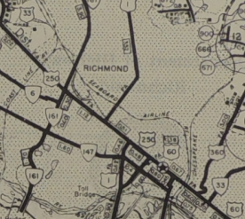 Henrico County maps ignore route 33 on Broad St 1945 Henrico County |
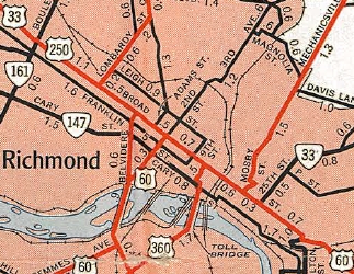
 Gen Drafting maps ignore route 33 on Broad St downtown 1948 Gen Draft |
VDOT Route Logs:
Route logs up through 1957 do not differentiate US form state in their general listing. However, there is a separate US route listing section. Unfortunately, US 33's endpoint is described as just "Richmond".
 US 33 and VA 33 not differentiated 1941 Route Log |
 US 33 not specific enough 1941 Route Log |
CTB documents:
The earliest reference that seems to indicate where the transition might be is in the Sept 1959 CTB.
AASHO documents: The Oct 18, 1937 VDOH internal memo states exactly where the US 33/VA 33 transition was to be: US 1 in Richmond. But was it US 1 north leaving Broad on Lombardy St or where it left south on Belvidere?
Postings in the field:
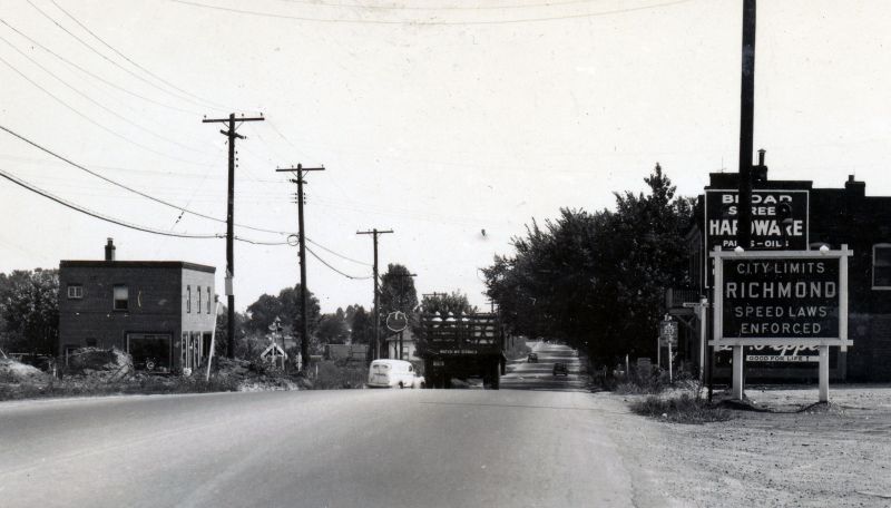
Below is a picture of US 250 east at US 33 Staples Mill Rd, from around 1940 plus-or-minus. Note that there is no indication that US 33 joins Broad St from this vantage point. The second picture is a close-up where you can make out the US 250 reassurance marker under the giant oak tree. There does not appear to be a US 33 or VA 33 route marker visible.
 US 250 east at US 33, around 1940 photo by R.L. Atwell, courtesy Wayne Henderson |
 zoom to Broad St reassurance marker past the intersection photo by R.L. Atwell, courtesy Wayne Henderson |
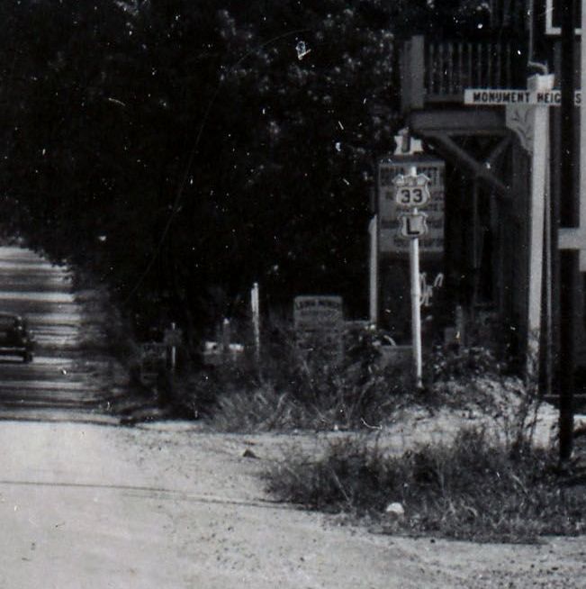
 Broad St west at 12th in the late 1940s. photo from a pictoral history of Richmond book |
![]()
![]()
Page last modified 8 March 2015
(C) 2015-2008 Mike Roberson, Adam Froehlig