< I-74 | Home | I-79 >
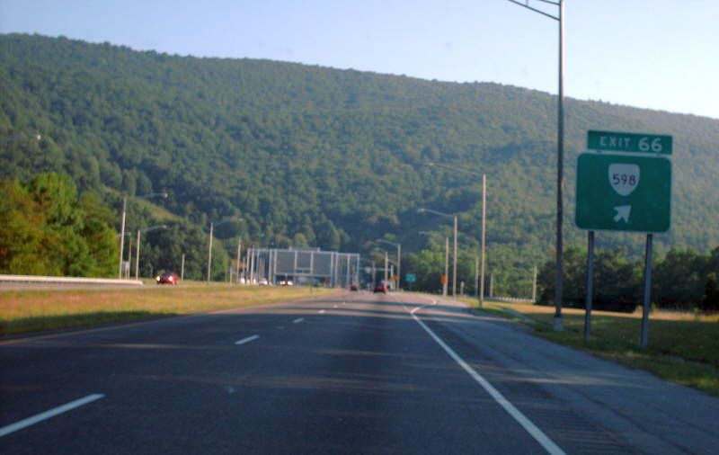
Photo: I-77 NB at VA 598 and unposted US 52. The East River Mountain Tunnel is straight ahead (Mapmikey 7-21-07)
|
|
|
| ROUTE LOG |
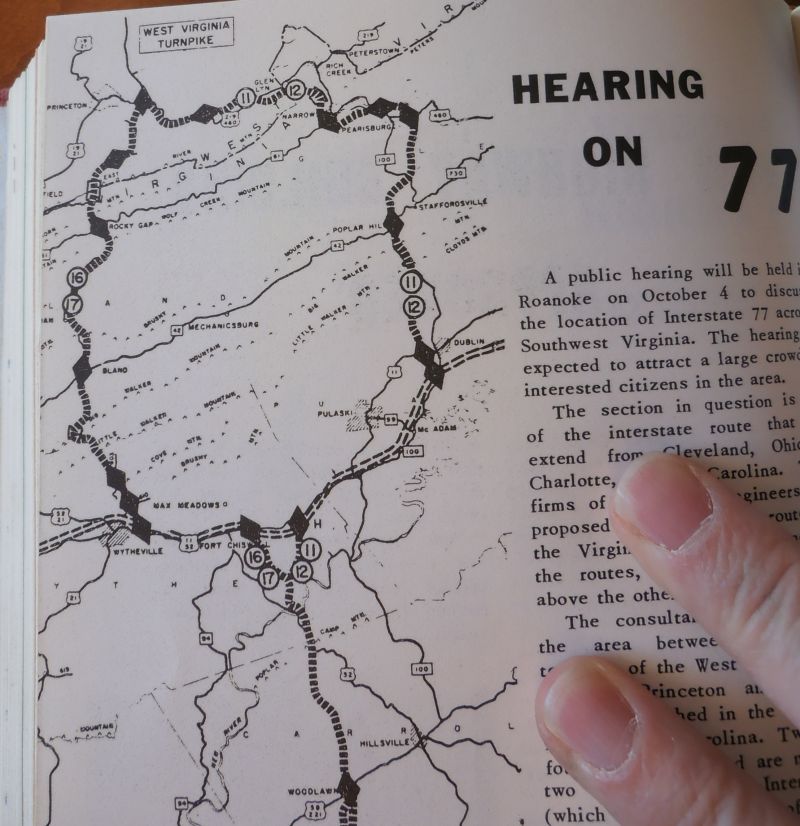
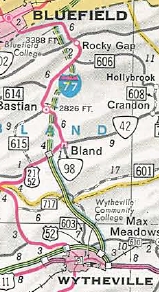
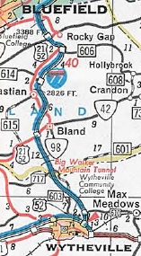
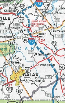
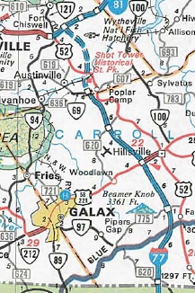
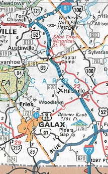
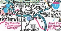
NC STATE LINE: 0 - 0 EXIT 1 - SR 620: 0.94 - 0.94 EXIT 8 (old 2) - VA 148: 7.63 - 8.57 EXIT 14 (old 3) - US 58, US 221: 6.28 - 14.85 EXIT 19 (old 4) - SR 620: 4.18 - 19.03 EXIT 24 (old 5) - VA 69: 5.03 - 24.06 Wythe-Carroll Line: 0.23 - 24.29 EXIT 32 (old 6) - I-81 NB (exit 81), US 11 NB: 7.85 - 32.14 EXIT 80 (old 25) - US 52 SB, VA 121: 2.25 - 34.39 EXIT 77 (old 24) - F-326: 2.31 - 36.70 EXIT 73 (old 23) - US 11 SB: 3.30 - 40.00 EXIT 40 (old 7) - I-81 SB (exit 72), US 52 NB: 1.29 - 41.29 EXIT 41 (old 8) - SR 610: 0.59 - 41.88 Bland-Wythe Line: 4.80 - 46.68 EXIT 47 (old 9) - SR 717: 0.69 - 47.37 EXIT 52 (old 10) - US 52, VA 42: 5.45 - 52.82 EXIT 58 (old 11) - SR 666: 6.11 - 58.93 EXIT 62 (old 12) - SR 606: 3.94 - 62.87 EXIT 64 (old 13) - US 52, VA 61: 1.97 - 64.84 EXIT 66 (old 14) - US 52 SB, VA 598: 2.24 - 67.08 WV STATE LINE: 0.79 - 67.87
|
Creation: I-77 was created as a renumbering of I-79 in mid-1958.
| Adjustments: In Dec 1960, the CTB voted to adopt the "western line" for I-77 both above and below I-81. The eastern line north of I-81 would've left I-81 at Dublin and followed VA 100's corridor to Pearisburg and US 460's corridor west to Princeton WV, with a tunnel west of Narrows. In April 1965, the CTB noted that North Carolina had adopted the eastern route for I-77 from Elkins north to I-81. Therefore Virginia went back and studied their eastern route and found it would be cheaper to use the eastern route. The CTB then voted to rescind the Dec 1960 decision for the western route below I-81 and adopt the eastern route. The first official Virginia map to show anything was unlabeled dotted lines on the 1967 issue.
Per Scott Kozel's website, the first segment to open was from I-81 Wytheville north through the Big Walker Tunnel to US 52/VA 42 Bland CH in Dec 1972. Per Kozel, Bland CH northward was opened in 5 sections from 1974-75. Note that most of I-77 NB between SR 606 and US 52/VA 61 was built essentially on top of the existing US 21-52 roadway. In Dec 1974 (Kozel), I-77 was opened through the East Mountain Tunnel to West Virginia.
In July 1977 (Kozel), I-77 was opened from North Carolina to today's VA 148. In Dec 1977 (Kozel), I-77 was opened from VA 148 to VA 69 Poplar Camp In Dec 1978 (Kozel), I-77 was opened from VA 69 to I-81. The I-77/81 segment from exit 77 to US 52/VA 121 Fort Chiswell was opened in Sept 1985. The last segment of I-77/81 to open was from today's exit 73 to exit 77, in July 1987. These last two segments were partially built on top of existing US 11-52 ROW.
Improvements: I-77 opened as 4-lanes everywhere except the I-81 duplex which was built as a 6-lane segment. There is a climbing lane up the long ascent that begins at Exit 1 and ends just past the Blue Ridge Pkwy overpass past Mile 7. Posted: Fully posted; Only 2 state-named shields were known to survive to 2010, both in Wytheville. The one on US 11 has definitely been replaced and I have no information on the Monroe St one which is shown in the Oct 2012 GMSV. There is a 77 in an SR rectangle at the jct of SRs 683 and 778 just south of Exit 8. This is the only interstate posting in a rectangle I have seen in Virginia. Multiplexes: I-81, US 11 (2.25 mi) I-81, US 11, US 52 (5.61 mi) I-81, US 52 (1.29 mi) US 52 (0.79 mi) Legislative names: James A Williams Jr Memorial Hwy, entire route (7-20-95); D. Woodrow Bird Memorial Hwy, Bland Co (since 3-16-03); Other names: None Scenic Byway: No segments Comments: The lowest F-route, F-001, is on I-77 in Bland County. I-77 totally blows off US 52 twice (at the New River Bridge and north of Bland). I-77 south of I-81 is pretty crowded with truck traffic and can get bogged down over the hilly terrain. I-77 has some scenic value on most parts of its journey. | |||||||||||||||
Previous: I-74 |
Next: I-79
Top | Virginia Hwy Index
Home
Page last modified 3 January 2015