I-240
< 26 | Home | 40 | 140 | 440 | 540 | 640 | 840 | 73 >
| I-240 9 miles | |||
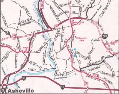
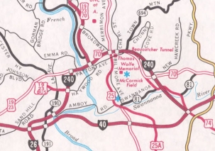
| The Road: | Begins at I-26/40 near West Asheville (Buncombe County) and ends at I-40/US 74-A near Oteen (Buncombe County). | Towns and Attractions: | Buncombe Co.: West Asheville, Asheville |
History: |
I-240 first showed up as a dotted line on the 1977 official map inset of Asheville. It did appear on commercial maps such as AAA in 1976 (albeit misidentified as I-140). I-240 was assigned to its entirety all at once in November 1980 (NCDOT): over existing unnumbered route from I-26/40 to NC 191 (posted EB as TO US 70)
Exit List:
|
Comments: |
I-240 has an impressive cut through Beaucatcher Mountain, literally next to the tunnel carrying US 70/74-A.
In the late 1980s there was still a US 25 cutout on I-240 WB. Also, on the freeway between I-26/40 you could see the backside of NC 191 and US 70 cutouts that had been covered by I-240 shields. |