Hampton Roads Joint Transportation Study
Prepared for the Southeastern Virginia Planning District Commission, the Peninsula Planning District Commission (these two now form the Hampton Roads Planning and Development Commission, or HRPDC), and the Virginia Department of Highways (now VDOT).
Prepared by Alan M.Voorhees & Associates, Inc and Hammer, Greene, Siler and Associates, October 1970.
[Webmaster's Note: This document, prepared for the precursors to the Hampton Roads Planning and Development Commission (HRPDC), reflects a summary of the late-1960s transportation plans for the Peninsula and Southside, and examines ways to improve access across the Hampton Roads.]
Summary
Objective
In the past, the lack of free movement across Hampton Roads has prevented the Region from achieving its full economic and social potential. The object of this study is to provide measures of the economic, social, and transport impacts of alternative ways of providing transportation service across Hampton Roads and to guide state and local agencies in the development of the future transportation and land use programs associated with Hampton Roads crossings.
Issues
With this study objective, the Joint Transportation Committee formulated and adopted a set of specific questions or issues which focused the technical aspects of the study:
- What are the economic and transport impacts when the
Peninsula and Southeastern subregions act as one?
- Are additional crossings of Hampton Roads required to
achieve the full economic potential of the region?
- If additional crossings are required, where should they be?
- What are the implications, both economic and transport, of
additional crossings on the local jurisdiction comprising the Hampton Roads
Region?
- What are the financial implications of providing for
additional crossings?
Findings and Conclusions
Significant findings and conclusions result from the analysis of existing conditions:
To overcome this barrier, traffic and the economic impacts of five alternative methods of providing transportation service across Hampton Roads were examined.
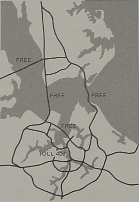
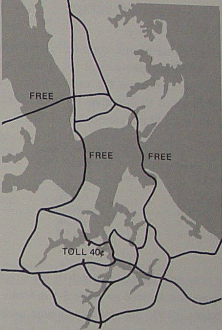
[Webmaster's Note: In the following five alternatives, the "third crossing" represents what became today's I-664 Monitor-Merrimac Bridge Tunnel, with the exception of the 1970 "third crossing" was proposed to follow the western edge of Craney Island instead of today's MMBT routing that is further west.]
Alternative 1 consists of the combined 1985 recommended plans from the regional transportation studies in the Southeastern and Peninsula Planning Areas, a third crossing between Newport News and the Southeastern subregion in the vicinity of Craney Island, and direct, toll free connections, from the third crossing to the downtown areas of Norfolk and Portsmouth. In this alternative, the James River Bridge, the Hampton Roads Bridge Tunnel, and the third crossing were assumed to be free and capable of handling traffic demands.
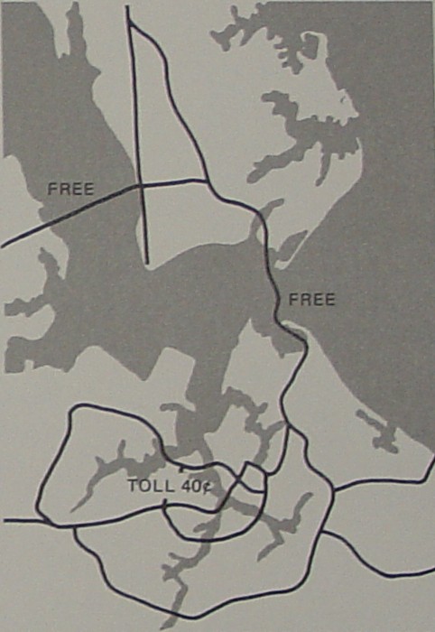
Alternative 2 assumes that the Hampton Roads Bridge Tunnel and James River Bridge are toll free. This alternative was designed to determine the traffic demands on the Hampton Roads Bridge Tunnel without a third crossing under toll free conditions. This is the minimum alternative because it assumed no additional facilities over and above those already planned.
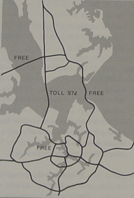
Alternative 3 provides for a third crossing between Newport News and the proposed Western Freeway in Portsmouth. It assumes that the tolls on the Elizabeth River Midtown Tunnel are removed. In addition, it was assumed that the third crossing would have tolls sufficient to amortize the cost of a third crossing and the debt remaining on the Elizabeth River Midtown Tunnel. However, both the James River Bridge and the Hampton Roads Bridge Tunnel were assumed to be toll free. This alternative was designed to determine if a third crossing could be self-supporting as a toll facility.
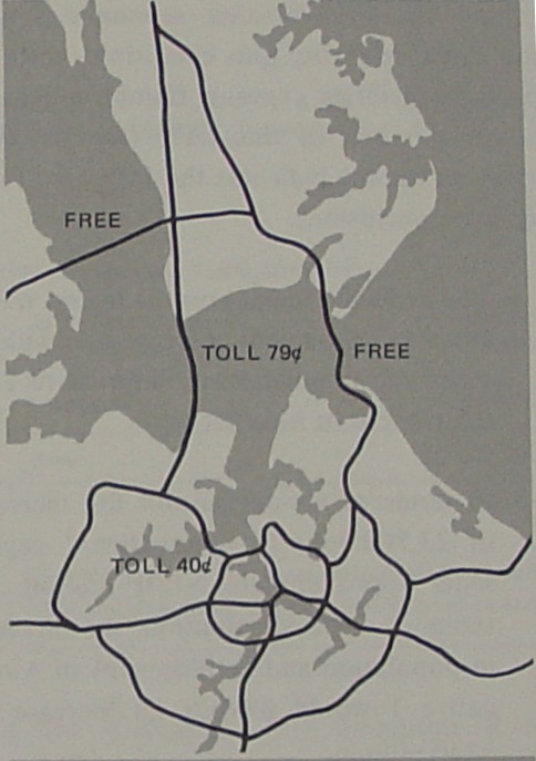
Alternative 4 is the same configuration as Alternative 3, with the exception that the Midtown Tunnel would retain its present tolls and the toll on the third crossing would only amortize that facility. In this alternative, the impact of Elizabeth River tolls on 1995 traffic crossing Hampton Roads was examined. The other facilities crossing Hampton Roads were considered toll free.
Alternative 5 consists of an all-free third crossing with a direct connection from the northern tip of Craney Island to the Belleville-Bowers Hill connector. This test was designed to measure the impact of providing direct service to the outer Metropolitan Loop serving the Portsmouth fringe, Nansemond county, and the City of Chesapeake while tying into the Western Freeway that provides access to the core areas of Norfolk and Portsmouth.
Economic Impacts
The estimated capital costs associated with each of these alternatives is summarized below. As indicated, the capital costs vary from a high of $356 million (1970 dollars) for Alternative 1 to a low of $113 million (1970 dollars) for Alternative 2.
| Alternative | Estimated cost ($ thousands) |
| 1 | 355,791 |
| 2 | 112,800 |
| 3 | 298,017 |
| 4 | 264,088 |
| 5 | 264,775 |
Table S-1. Summary of Economic Impacts:
| Baseline Projection |
Increase over Baseline Projection for Alternative | ||||||||||
| Alt. 1 | Alt. 2 | Alt. 3 | Alt. 4 | Alt. 5 | |||||||
| Number | % | Number | % | Number | % | Number | % | Number | % | ||
| Southeastern Subregion | |||||||||||
| Employment | 464,200 | 16,600 | 3.6 | 2,100 | 0.5 | 11,900 | 2.6 | 12,900 | 2.8 | 14,500 | 3.1 |
| Population | 1,178,200 | 42,100 | 3.6 | 6,100 | 0.5 | 30,400 | 2.6 | 32,700 | 2.8 | 36,800 | 3.1 |
| Peninsula Subregiona | |||||||||||
| Employment | 243,000 | 7,100 | 2.9 | 1,150 | 0.5 | 4,600 | 1.9 | 4,900 | 2.0 | 6,000 | 2.5 |
| Population | 582,900 | 17,000 | 2.9 | 2,700 | 0.5 | 11,000 | 1.9 | 11,700 | 2.0 | 14,400 | 2.5 |
| Hampton Roads Region | |||||||||||
| Employment | 707,200 | 23,700 | 3.4 | 3,250 | 0.5 | 16,500 | 2.3 | 17,800 | 2.5 | 20,500 | 2.9 |
| Population | 1,761,100 | 59,100 | 3.4 | 8,800 | 0.5 | 41,400 | 2.3 | 44,400 | 2.5 | 51,200 | 2.9 |
The economic impacts for each of the alternatives are summarized in Table S-1 (above) in terms of increases in 1995 population and employment for each subregion over a baseline set of conditions. The 1995 baseline economic projection assumes status quo conditions with respect to facilities crossing Hampton Roads. An examination of this table from an economic viewpoint indicates the following findings and conclusions:
Traffic Impact
Table S-2, Characteristics of 1995 Traffic Crossing Hampton Roads:
| Table IX - Major Thoroughfares - Norfolk | |||||
| 1 | 2 | 3 | 4 | 5 | |
| 1995 Average Vehicular Trip Length1 | |||||
| Minutes | 34.0 | 35.2 | 34.2 | 33.8 | 35.0 |
| Miles | 21.5 | 23.5 | 21.6 | 21.0 | 21.6 |
| 1995 Average Daily Traffic Demand2 | |||||
| James River Bridge | 22,700 | 37,500 | 26,300 | 25,300 | 24,800 |
| Hampton Roads Bridge Tunnel | 69,500 | 96,800 | 107,600 | 84,500 | 74,700 |
| Third Crossing | 84,900 | -- | 11,700 | 26,800 | 45,800 |
| Total | 177,100 | 134,300 | 145,600 | 136,600 | 145,300 |
| 1 - For trips made within the Hampton Roads Region only. 2 - Four lanes of available capacity were assumed on each crossing of the Hampton Roads for analysis purposes. |
|||||
Using the traffic forecasting methodology described in Chapter III and the economic impacts analyses, the traffic impacts of each of the alternatives were determined. Table S-2 (above) summarizes characteristics of 1995 traffic crossing Hampton Roads. From a transportation viewpoint, the following findings and conclusions emerged:
Financing
One of the major issues associated with the provision of a third crossing was the question of financing. To determine whether this facility could be self-supporting through revenue bonds, a special analysis was made. The results of this analysis indicated that the third crossing cannot be self-supporting, under any toll rate structure and would as a minimum require a grant capital subsidy of $80 million.
Based on the testing of the traffic and economic impacts of the alternatives investigated and the criteria of the Hampton Roads Joint Transportation Study Committee, the following conclusions and recommendations were developed:
[Webmaster's Note: The rest of the study report will be added as a future project.]
Return to Hampton Roads Notes
Return to the Virginia Highways Project