Last update: 1/9/15
 |
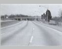
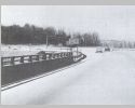
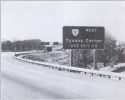
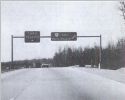
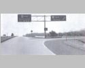
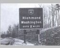
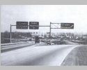
Mileage sign on the Outer Loop north of MD 202 at the Glenarden Pkwy. The expert didn't like that it said Annapoils was 21 miles then just ahead the BGS for US 50 said a mile to "US 50 Annapolis." I guess some peope are easily confused. |
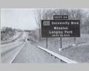 |
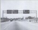
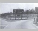
Approaching Exit 24 for MD 193 Wheaton and Langley Park. in Maryland, there were no exit suffixes then. Instead, the exit tab would be plural if there were multiple ramps. |
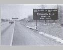 |
Approaching MD 193 north for Wheaton. You also have to exit here if you want to get to US 29 north. |
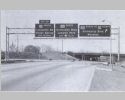 |
At MD 193 north for Wheaton, with Exit 23 for US 29 south coming up. |
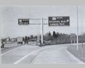 |
At MD 193 south for Langley Park, with Exit 23 for US 29 south approaching. |
 |
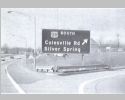
Approaching Exit 23 for US 29 south to Silver Spring. |
 |
Approaching the ramp for US 29 south to Silver Spring. |
 |
At the merge from US 29 north to I-495 west. The expert noted that there is poor visibility to see where your ramp to US 29 south is located. |
 |
At the US 29 overpass. Now you can see where your ramp to US 29 south is located. |
 |
At the ramp to US 29 south. |
 |
Approaching Exit 19 for I-70S and MD 355. |
 |
Approaching the ramp for MD 355 Rockville. |
 |
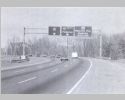
At the ramp for MD 355 Rockville with the ramp to I-70S coming up. You can also see the BGS set shown for Rockville Pike north at the ramps for the Beltway and for I-70S (now I-270). This is where US 240 went from Rockville Pike to I-70S but I don't see any postings reflecting this. |
 |
At the ramp for I-70S. The experts did not like that these ramps for two different roads were given just 1 exit number. Today they have two different exit numbers. |
 |
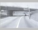
Just inside Virginia is the ramp for Exit 14 to the George Washington Memorial Pkwy. Today this is a C/D lane that covers both Exit 14 and Exit 13 in these pictures. The two exits have the last original bridges across the beltway still standing. |
 |
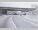
At the ramp for Exit 13 to VA 193 Great Falls/Langley. |
|
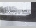
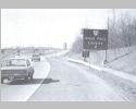
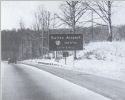
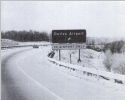
A set of two pics at the same location. This is approching Exit 12 for the Dulles Airport Access Rd with a large blank space. This space was eventually filled with a To 123 North line. |
 |
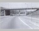
At the overpass for SR 694 Lewinsville Rd. Trucks are not allowed to use the Access Rd to the airport. |
 |
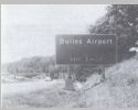
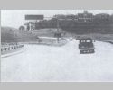
Approaching the ramp to the Dulles Airport Access Road. |
 |
A little closer to the ramp. |

|
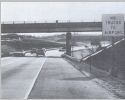
A set of two pics at the same location. This is at the Exit 12 ramps, one on each side of the highway offset a few hundred feet Note the blank sign at the left ramp. This space was eventually filled with a To 123 North line. |
 |
Approaching the left ramp to the Dulles Airport Access Road east which only went to VA 123 then. This is on the bridge crossing the Dulles Access Road. |
|
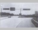
A set of two pics at the same location. This is at the Exit 12 left ramp. Note the blank sign at the left ramp. This space was eventually filled with a To 123 North line. |
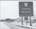 |
Approaching Exit 11 for VA 123 Vienna/McLean. |
 |
Back then there was no ramp from I-495 south to VA 7 west so you had to use VA 123 south to get there. |
 |
Approaching Exit 11S for VA 123 south. |
 |
At Exit 11S for VA 123 south. The THRU TRAFFIC BGS was quite common back in those days. |
 |
At Exit 11N for VA 123 north. The view here today has numerous tall commercial buildings. |
 |
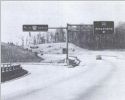
At Exit 10 VA 7 west. |
 |
At Exit 10 VA 7 west at the ramp. |
 |
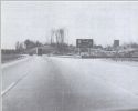
Mileage sign just after the VA 7 interchange. |
 |
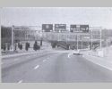
Approaching Exit 8 for US 50 Fairfax/Washington. These days they sign it for Arlington instead of Washington. |
 |
On the C/D ramp approaching the US 50 west exit. |
 |
On the C/D ramp at the US 50 east exit. |
 |
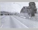
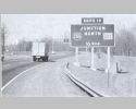
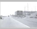
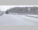
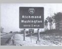
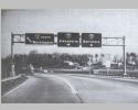
Mileage sign after Exit 7 for SR 650 Gallows Rd. The bridges in the background are VA 236. I think Annapolis is kind of an odd choice here. Today there are no mileage signs like these on the Virginia portion of the beltway. I can't think of anywhere else in Virginia that has Annapolis on a road sign. |
 |
Mileage sign after Exit 5 for SR 620 Braddock Rd. |
 |
Advance notice for I-95 2 miles ahead. |
 |
Advance notice for I-95 1 mile ahead. |
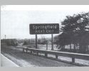 |
Springfield is reached via 95 south ahead. |
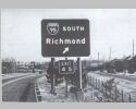 |
Approaching the Exit 4S ramp to I-95 south. |
 |
At the Exit 4S ramp to I-95 south. |
 |
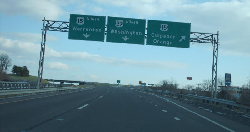
At the Exit 4N left ramp to I-95 north. The numerals in the 495 shields are tiny! The expert took issue with the single lane pull down for Alexandria in the left lane and Baltimore in the right lane. He said those signs suggested drivers needed to be in those lanes right away. If they were switched I personally would think that would make sense...keep right because Alexandria is relatively soon and keep left as thru traffic for Baltimore. Virginia didn't learn its lesson based on this Culpeper interchange. |
 |
This picture from fairfaxunderground.com appears to be from just before the beltway opened and is just past the I-95 exit. |
 |
This picture from fairfaxunderground.com is nearer the bridge over the railroad and starting approach to Exit 3 for SR 613 Franconia. |
 |
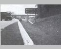
At the Exit 2 ramp to VA 241 north. The bridge just crossed is over Cameron Run |
Return to 495 Vintage Gallery main page.
![]()
![]()
Page last modified 9 January 2015
(C) 2015-2008 Mike Roberson, Adam Froehlig