 |
From:  Melissa (Cabell County) Melissa (Cabell County)
To:  Barboursville (Cabell County) Barboursville (Cabell County)
Total Length: 2.6 miles
|
|
|
|
|
ROUTE LOG
WV 10: 0 - 0
US 60: 2.6 - 2.6
|
|
Creation: Created between 1967-70 as a renumbering of WV 10, running the way it does now. This is the 2nd WV 10 ALT. See scans below.
Adjustments: None
Improvements: Fully paved upon inception; no mutlilane segments
Comment: WV 10 ALT is fully posted.
|
| Previous WV 10 ALT's:
1965 ROUTE LOG
WV 10: 0 - 0
I-64: 4.4 - 4.4
US 60: 4.0 - 8.4
|
|
WV 10 ALT #1: Appeared between 1951-56 as a renumbering of WV 10 from Melissa to Huntington.
Between 1967-70, WV 10 ALT went back to being WV 10. Note that west of I-64, WV 10 used Bennetts Point Dr (no longer connects with), Park Pointe Way, and part of Crestmont Dr.
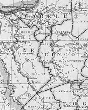
WV 10 Logan to central Huntington
1922 Official
|
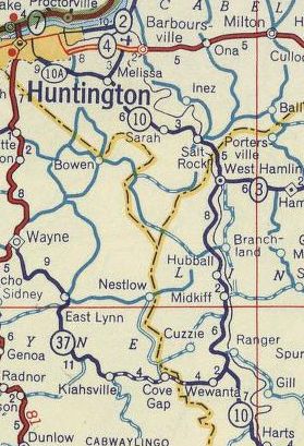
WV 10 ALT to central Huntington
1956 Shell
|
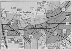
WV 10 ALT heads to Barboursville instead
1970 Traffic Count
|
|