< WV 101 | Home | WV 103 >
|
|
|
| ROUTE LOG |
Virginia State Line: 0 - 0 Virginia State Line: 3.0 - 3.0 GAP IN ROUTE Virginia State Line: 0 - 3.0 Virginia State Line: 0.2 - 3.2
|
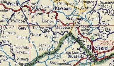
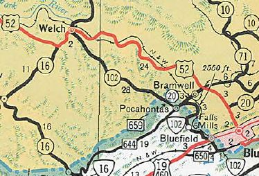
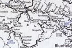
Creation: Appeared about 1959, running as it does today plus a 3rd segment ran from the Virginia State Line northwest of Pocahontas to US 52/WV 16 Welch. All 3 segments were a renumbering of WV 85. This is the only WV 102.
| Adjustments: Between 1978-80, Wv 102 from Welch to the Virginia Line northwest of Pocahontas VA was renumbered as WV 103, an extended WV 161, and CR 84. Improvements: Upon designation, WV 102 was fully paved except about 4 miles off the northwest Pocahontas border towards Anawalt which never became fully paved while WV 102; WV 102 has no mutilane segments. Comment: WV 102 does not connect with any other part of the West Virginia Primary System. Most maps are not detailed enough to show that their is a very brief dip into Virginia between Pocahontas and Yards. This is signed in the field though. VA 102 comes back to the West Virginia line southeast of Bluefield VA but I have found no evidence the road into West Virginia there was ever in the primary system. Virginia turned down a West Virginia Request in 1949 to put SR 659 into their primary system to connect then-WV 85 from Welch to Pocahontas VA and the existing VA-WV 85.
| ||||||||
Previous: WV 101 |
Next: WV 103 |
Top | West Virginia Hwy Index
Home
Page last modified 18 November 2017