< US 29 | Home | US 52 ALT | US 52 Bus | US 52 SPUR | US 52-Y | US 76 >
|
|
|
|
| ROUTE LOG |
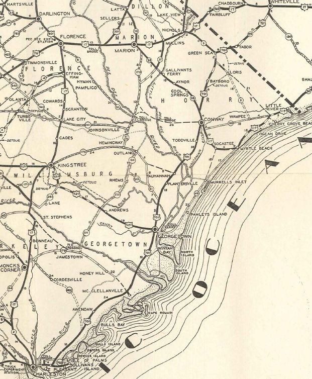
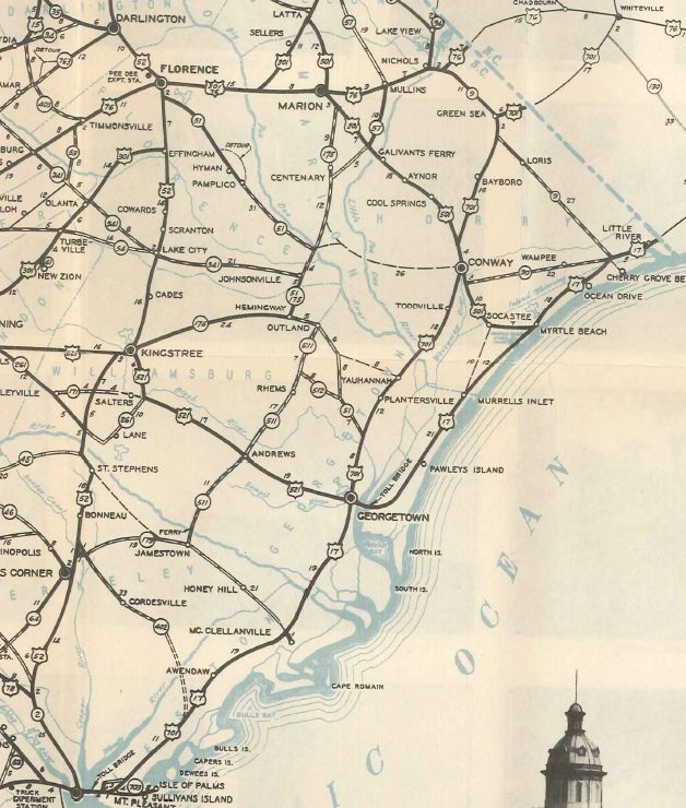
Line St: 0 - 0 I-26 (exit 221): 0.4 - 0.4 US 17: 1.0 - 1.4 US 52 SPUR: 0.7 - 2.1 I-26 (exit 217): 1.5 - 3.6 US 78 EB: 1.0 - 4.6 SC 7: 0.5 - 5.1 SC 642: 0.2 - 5.3 I-526 (exit 18): 3.0 - 8.3 I-26 CONN: 5.0 - 13.3 US 78 WB: 1.1 - 14.4 Berkeley-Charleston Line: 1.2 - 15.6 US 176: 0.8 - 16.4 SC 6: 15 - 31.4 US 17 ALT SB: 0.9 - 32.3 SC 402: 1.5 - 33.8 US 17 ALT NB: 0.4 - 34.2 SC 45: 13.2 - 47.4 Williamsburg-Berkeley Line: 8.5 - 55.9 SC 375: 1.3 - 57.2 US 521: 4.9 - 62.1 SC 261 WB: 7.5 - 69.6 SC 261 EB, SC 527 SB: 2.4 - 72.0 SC 527 NB: 0.6 - 72.6 SC 512: 8.6 - 81.2 Florence-Williamsburg Line: 3.3 - 84.5 US 378 Bus, SC 341: 2.9 - 87.4 US 378: 1.3 - 88.7 SC 541: 5.6 - 94.3 US 301 SB, SC 327: 7.1 - 101.4 US 301 NB: 6.0 - 107.4 SC 51: 1.6 - 109.0 US 76: 1.9 - 110.9 I-95 (exit 164): 3.2 - 114.1 Darlington-Florence Line: 1.6 - 115.7 US 52 Bus: 3.5 - 119.2 SC 340: 1.4 - 120.6 US 401 SB: 0.6 - 121.2 SC 34, SC 151: 0.3 - 121.5 US 52 Bus: 2.8 - 124.3 US 15 SB: 10.8 - 135.1 US 15 NB, US 401 NB: 2.1 - 137.2 Chesterfield-Darlington Line: 0.8 - 138.0 US 1 SB: 10.3 - 148.3 SC 9 WB: 2.3 - 150.6 US 1 NB, SC 9 EB: 1.4 - 152.0 NC STATE LINE: 9 - 161.0
|
Creation: Although an original US route, US 52 didn't come to South Carolina until 1935 as a renumbering of US 17 from Charleston to Florence and US 601 from Florence to North Carolina above Cheraw.
|
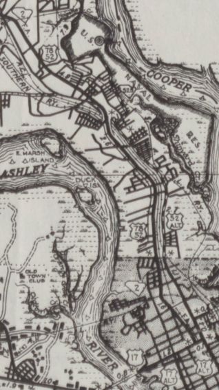
In 1947, US 52 was rerouted to leave Rivers Ave via Carver Ave to Meeting St all the way to US 17-701 Lee St, replacing some of SC 525 (which had been US 52 ALT). The old route via King St remains US 78 to Coming St.
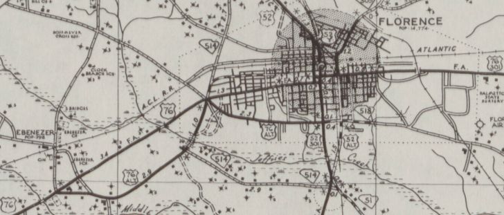
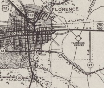
Also around 1947, US 52 was put on its current routing through Florence, replacing US 52-Y on Irby St. US 52 had been using Coit St and Palmetto to Irby. Coit St is now US 52 CONN and Palmetto remains part of US 76.
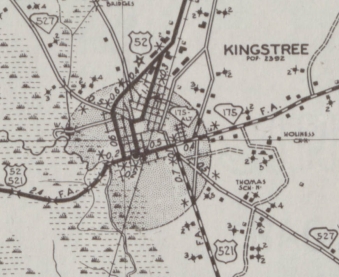
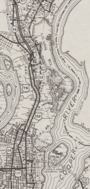
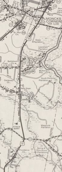
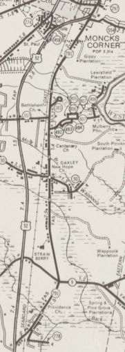
About 1949, US 52 was straightened out west of Kingstree through the Black River Swamp, leaving behind abandoned (but still partially driveable when it is dry) routing to the south. In 1971, US 52 was moved onto new alignment between Strawberry and Moncks Corner, avoiding Oakley. The old route became S-8-791.
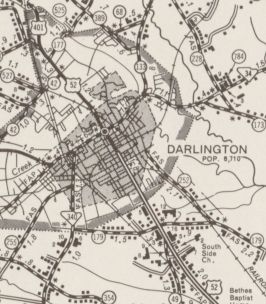
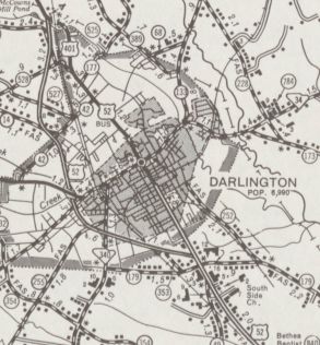
About 1973, US 52 was placed on new construction as a bypass west around Darlington, leaving behind US 52 Business.
In 2001, US 52 was placed on some new alignments leaving behind abandoned routing at SC 375 and Dickie Swamp, plus Old US 52 near the RR south of US 521. Improvements: US 52 was fully paved on designation except for Cheraw to North Carolina, which wasn't fully paved until 1939. The first piece of US 52 to be 4-lane was in place by 1939, from the US 78 EB split north to Durant Ave. in North Charleston. In 1941, US 52 was 4-laned out to US 176 Goose Creek. By 1946, US 52 was 4-laned from Florence to Darlington. About 1961, US 52 was 4-laned on its US 1 multiplex In 1963, US 52 was 4-laned from Florence south to SC 51. Also, By 1963 US 52 was 4-lane below S-10-32 Spruill Ave. In 1968 or 1969, US 52 was 4-laned from US 176 north to Mount Holly. Also, US 52 was 4-laned from SC 51 to Effingham. In 1971 (dates of bridges), US 52 was 4-laned from Mount Holly to Moncks Corner. In 1973, US 52 was 4-laned from Kingstree to Lake City. In 1974, US 52 was 4-laned from Lake City to Effingham. Also in this timeframe, US 52 was 4-laned on the Darlington Bypass. In 1975, US 52 was 4-laned through Moncks Corner to the US 17 ALT NB split. In the early 1980s, US 52 was 6-laned from Durant Ave north to the I-26 CONN, and 8 laned from there to the US 78 WB split. In 1987 or 1988, US 52 was 4-laned from US 17 ALT north about halfway to Bonneau. By the early 1990s, US 52 was 6-laned through Goose Creek. Between 1998-2000, US 52 was 4-laned through Bonneau and St. Stephen. In 2001, US 52 was 4-laned from St. Stephen to Kingstree. This makes US 52 4-lane continuous from the US 78 EB split to north of Darlington. Maps show US 52 as 4-lane between Spruill Ave and US 78 but 95% of this is still 2-lane. Comment: US 52 serves as a major route from Charleston to Florence, carrying a number of 60 MPH speed limit zones. US 52 is signed as E-W and N-S in various parts of the state. There is a signed US 52 TRUCK in Cheraw using Manor Rd, Cash Rd, and Front St. Been around at least 10 years. There is also a signed US 52 TRUCK in Florence, using US 301 and Church St. This one goes back to at least the 1990s. | |||||||||||||||
Previous: US 29 |
Next: US 52 ALT | US 52 Bus | US 52 SPUR | US 52-Y | US 76
Top | South Carolina Hwy Index
Home
Page last modified 2 August 2017