<SC 401 | Home | SC 403 >
|
|
|
| ROUTE LOG |
US 17 ALT, US 52: 0 - 0 SC 41: 16.1 - 16.1
|
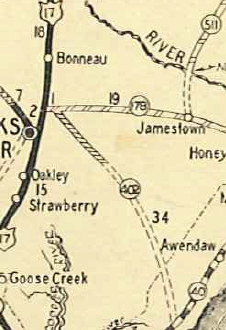
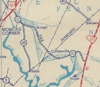
Creation: SC 402 appeared about 1929 as new primary routing, running from SC 179 (now S-8-360) near Moncks Corner southeast to SC 40 (now US 17) several miles southwest of Awendaw. This is the only SC 402.
|
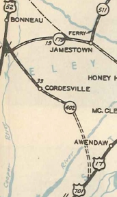
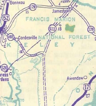
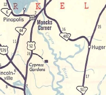
Adjustments: It appears only the road to McKnoghts Crossroads (current SC 41 jct) was actual highway while the rest was projected road. In 1934 or 1935, SC 402 north was extended to US 52. In 1939, SC 402 south was truncated to Huger Bridge. The road to McKnights Crossroads became part of SC 511. In 1943, SC 402 east was re-extended to McKnights Crossroads to meet the relocated SC 511 (now SC 41). In 1947, SC 402 was dongraded to S-8-11. In 1951, SC 402 was restored to running from US 17 ALT-52 to SC 511 (now SC 41). Between 1981 and 1987, SC 402's north end was put on new alignment to meet US 17 ALT/52 right at the Tail Race Canal bridge. The old route to the US 17 ALT-US 52 split became S-8-1509 Turnaround Ct.
Improvements: Fully paved when resurrected in 1951; no multilane segments Comment: The projected routing to today's US 17 was along the general corridor of today's SC 41, S-8-598, and S-10-98. On US 17 ALT-52 the sign for Huger says it is 20 miles even though it is only 16. It has been like this back to at least 1977. | ||||||||||
Previous: SC 401 |
Next: SC 403
Top | South Carolina Hwy Index
Home
Page last modified 23 May 2015