< SC 136 | Home | SC 137 ALT | SC 138 >
|
|
|
| ROUTE LOG |
SC 93: 0 - 0 SC 133 SB: 4.8 - 4.8 SC 133 NB: 0.5 - 5.3 SC 183: 3.1 - 8.4
|
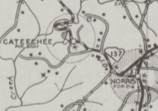
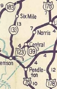
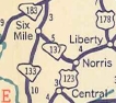
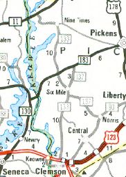
Creation: SC 137 appeared in 1940 as new primary routing, running from SC 13 (now SC 93) Norris to SC 133 Six Mile. This is the only SC 137.
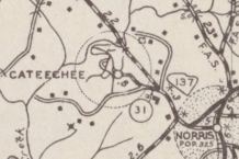
| Adjustments: In 1942, SC 137 was rerouted on new construction around Cateechee, leaving behind SC 137 ALT (now S-39-31) and abandoned routing west of Shoal Creek.
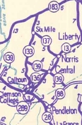
In 1947, SC 137 was downgraded to S-39-13. In 1950, SC 137 was restored to the primary system. In 1976, SC 137 was extended with SC 133 through Six Mile, then replaced SC 133 northeast to SC 183. Improvements: SC 137 was paved upon designation; no multilane segments Comment: SC 137 scrapes the west edge of Six Mile Mountain.
| |||||||||||
Previous: SC 136 |
Next: SC 137 ALT | SC 138
Top | South Carolina Hwy Index
Home
Page last modified 11 September 2015