< SC 132 | Home | SC 134 >
|
|
|
| ROUTE LOG |
US 76, US 123, SC 28: 0 - 0 SC 137 SB: 8.3 - 8.3 SC 137 NB: 0.5 - 8.8 SC 183: 2.2 - 11.0 SC 11: 9.9 - 20.9
|
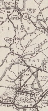
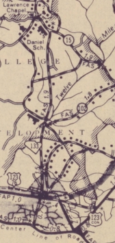
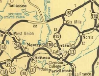
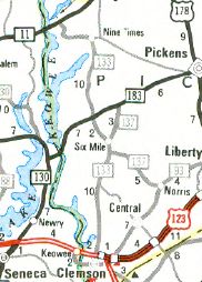
Creation: SC 133 appeared in July 1937 (SCDOT) as what I believe to be a renumbering of a different designated route (possibly SC 13 ALT) from US 76/SC 13-24 (now SC 93) from Clemson College to today's US 76-123/SC 28 Calhoun (now part of Clemson), then continued as new primary routing to SC 183 northeast of Six Mile. This is the only SC 133.
| Adjustments: Between 1954-59, SC 133 was rebuilt north of Calhoun onto mostly new construction plus replaced some S-39-15. This left behind Calhoun St, Clemson Rd, Old Jewel Bridge Rd, and Old Six Mile Rd
In 1976, SC 133 north was rerouted at Six mile to instead head northwest replacing S-39-45, S-39-50, and S-39-32 to SC 11. The old route northeast of Six Mile became part of SC 137.
Sometime after 1993, SC 133 south was truncated to US 76-123/SC 28.
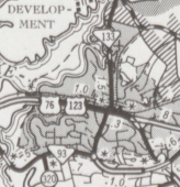
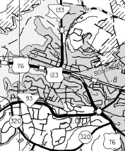
Improvements: SC 133 was paved upon designation By the late 1980s, SC 133 was multilaned for 3/4 mile centered around US 76-123/SC 28. Comment: SC 133 provides an easy connection from SC 11 or SC 183 to Clemson. | |||||||||||
Previous: SC 132 |
Next: SC 134
Top | South Carolina Hwy Index
Home
Page last modified 12 September 2015