< SC 100 | Home | SC 101 ALT | SC 102 >
|
|
|
| ROUTE LOG |
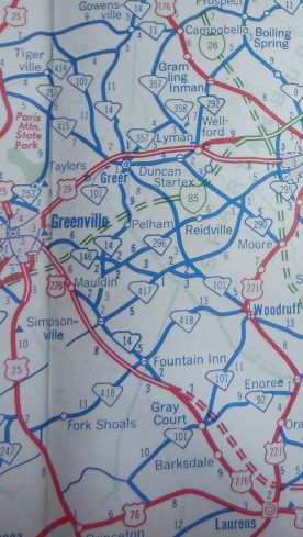
US 76: 0 - 0 SC 14 NB: 9.4 - 9.4 SC 14 SB: 0.4 - 9.8 SC 92: 0.1 - 9.9 I-385 (exit 16): 1.6 - 11.5 Spartanburg-Laurens Line: 5.6 - 17.1 US 221 SB, SC 146 EB: 3.6 - 20.7 US 221 NB: 0.9 - 21.6 SC 418: 0.2 - 21.8 SC 146 WB: 4.5 - 26.3 SC 417: 2.3 - 28.6 SC 296: 2.9 - 31.5 I-85 (exit 60): 2.9 - 34.4 SC 80: 3.5 - 37.9 SC 290 EB, SC 357: 1.8 - 39.7 Greenville-Spartanburg Line: 0 - 39.7 SC 14: 0.3 - 40 US 29 NB: 1.7 - 41.7 US 29 SB: 0.1 - 41.8 SC 290 WB: 0.4 - 42.2 SC 414 EB: 11.1 - 53.3 SC 414 WB: 0.1 - 53.4 SC 11: 2.6 - 56.0
|
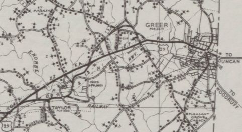
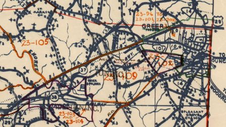
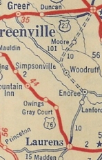
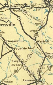
Creation: SC 101 appeared in 1928 as new primary routing, running from SC 10 (now US 221) Woodruff to US 29 (now SC 290) Greer. This is the only SC 101.
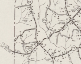
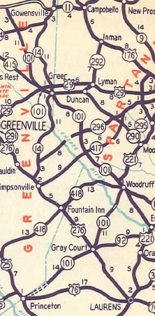
| Adjustments: In July 1936 (SCDOT) a separate SC 101 piece was created from the Enoree River southwest through Gray Court to Bellinger Rd just past today's S-30-54 jct. In Dec 1937 (SCDOT), SC 101 was extended with US 221 through Woodruff, then southwest as new primary to the Enoree River to meet the piece from Gray Court. By 1940, SC 101 was removed from Old Woodruff Rd S-23-577 in Greer; also put on its current route between today's SC 80 and S-42-12 Brockman McClimon Rd (leaving behind SC 101 ALT which none of this is public road as S-42-12 has totally been changed. The E-W portion of old SC 101 ALT runs over the BMW Fire Dept driveway and the N-S portion uses some of Gateway Dr.); S-42-399 Old Woodruff Rd just north of I-85; Sloan St in Woodruff. In 1940, SC 101 was shown as projected from S-30-54 southwest to US 76 Princeton. In 1942, SC 101 north was extended replacing US 29 on Poinsett St from downtown Greer west to the new routing of US 29.
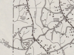
In 1949, SC 101 was extended north as new primary routing over S-23-91 to SC 11. By 1952, SC 101 was extended south as new primary routing to the Greenville County Line, with a projected route still showing to Princeton.
In 1959, SC 101 south was redirected to replace S-30-54 south to US 76 Hickory Tavern, leaving behind S-30-20 and they never have built the road to Princeton. In the mid-2000s, SC 101 was put on a brief duplex with US 29 over to Buncombe Rd leaving behind S-23-298 O'Neal Rd. Improvements: SC 101 was paved from Greer south about 5 miles in 1936. In 1937, SC 101 was paved completely between Greer and Woodruff In 1938, SC 101 was paved from Woodruff south to the Enoree River. Between 1943-48, SC 101 was paved in its entirety, except for the Enoree River Bridge area. SC 101 was finally fully paved in 1952. SC 101 was 4-laned from SC 14 to US 29 by the mid-1980s. SC 101 was 4-laned from near SC 296 to Greer in 1997. In 2006, SC 101 was multilaned from SC 417 to Woodruff. In 2012, SC 101 was multilane from SC 296 to SC 417. Comment: SC 101 serves the Greenville-Spartanburg Airport area.
| |||||||||||||
Previous: SC 100 |
Next: SC 101 ALT | SC 102
Top | South Carolina Hwy Index
Home
Page last modified 11 August 2017