


Old General Signs
This page highlights the old signs that made it to at least 2005. All pictures by Mapmikey unless noted.
Last update: 11/5/16 (11 new photos)
|
|
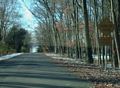
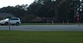
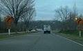
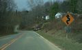
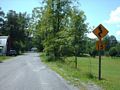
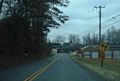
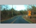
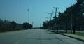
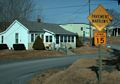
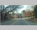
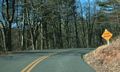
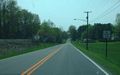
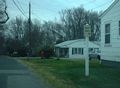
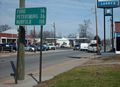
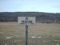
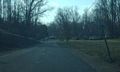
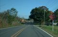
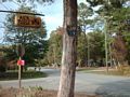
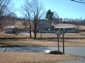
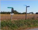
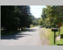
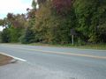
Neighborhood street off VA 402. A number of neighborhoods have these signs which look pretty old and have non-contemporary fonts. Taken 8/30/07. |
|
|
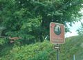
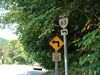
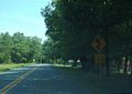
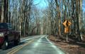
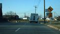
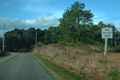
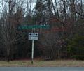
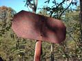
A faded out waypoints sign at the north end of VA 16 ALT. This was still there summer 2007. Taken by Froggie, 8/13/05. |
|
|
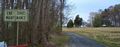
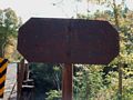
This is the backside of the photo above. If you look closely at the waypoints sign underneath the cutouts, you'll see what may be the original late 50s sign which was simply covered over. Too bad it can't be pulled down to see... Taken 7/21/07. |
|
|
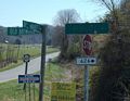
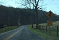
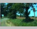
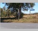
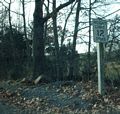
This is on SR 800 which used to be VA 103's approach to VA 8. This sign may go back to around 1970 when VA 103 was rerouted. Taken 4/13/07. |
|
|
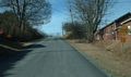
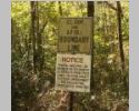
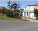
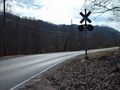
This is on SR 654 in Charles City County. This was VA 156's southbound descent to the James River Ferry, which was in use until 1967. Taken 4/13/07. |
|
|
This is just off SR 730 near Eggleston. This was the descent to its New River bridge until its replacement in 1980. Taken 3/14/08. |
|
|
|
|
|
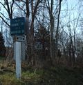
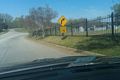
A scarce white waypoint sign, on SR 626 (old VA 94) in Baywood. Taken 4/13/07. |
|
|
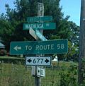
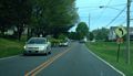
This is at the jct of SRs 614-616. A more modern Belroi sign is posted nearby. Taken 10/19/10. |
|
|
A faded destination sign at the SR 622-626 jct. SR 626 used to be VA 94. This probably dates to when US 58-221 (just behind me) was straightened out in the early 80s. Taken 4/13/07. |
|
|
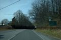
This is SR 779 (old VA 114) east of Catawba. The sign pole seems overly thick. Taken 12/5/08. |
|
|
This is leaving Christiansburg. Taken 12/5/08. |
|
|
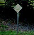
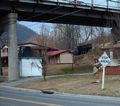
This is a green embossed rescue squad sign. I'd never seen one of these before...the only older versions I'd seen were the green on white square signs. This is on an old alignment of SR 645 near VA 80 Honaker. Taken 7/21/07. |
|
|
I don't recall seeing one of these anywhere else. On a side street in a bad sun field in Ivanhoe. Taken 9/3/10. |
|
|
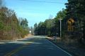
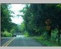
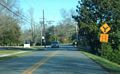
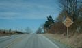
A well-cracked one-lane bridge sign on SR 617 just off VA 202 Hyacinth. Taken 2/16/07. |
|
|
This is on US 301 SB in South Emporia. Taken 3/6/10. |
|
|
This is on US 301 NB in South Emporia. Taken 3/6/10. |
|
|
This is SR 670, an old alignment of 1920's US 15 in New Canton. This sign says "Charles T. Woodson memorial highway". This was still there in March 2008. Taken 12/9/06. |
|
|
Here is a sign assembly with two different aging destination signs. This used to be where VA 75 south turned right. This is a couple miles or so south of I-81. Perhaps a 75 cutout sat at the very top where there's space?? Taken 8/18/07. |
|
|
Winchester replaced all their cutouts in the last few years but elected to hold on to this sign. Taken 10/23/08. |
|
|
This is on VA 65 at its endpoint with US 58 ALT. Taken 9/5/09. |
|
|
This is on VA 55 EB leaving Marshall. Taken 9/27/09. |
|
|
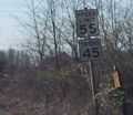
This clearance sign, which I think -was- yellow, is on the south end of the 1884 bridge that VA 45 used over the James River until it was destroyed by Hurricane Agnes in 1972. Taken 2/15/08. |
|
|
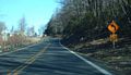
This is on VA 16 southbound just inside Tazewell town limits. VA 16 ALT is just around this corner. Taken 7/21/07. |
|
|
This faded curve warning is on US 58 Business eastbound leaving Emporia and connecting back to mainline US 58. Taken 1/21/08. |
|
|
This is on VA 232 northbound just inside Radford. Taken 3/14/08. |
|
|
This is on SR 616 south of Low Moor. Had VA 42 ever been connected everywhere this would've been part of it. Taken 3/14/08. |
|
|
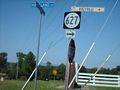
This is on SR 684 (old VA 27) near Mohemency. Taken 2/15/08. |
|
|
This is near the entry above. Taken 11/7/08. |
|
|
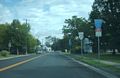
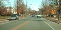
SB US 11 in the City of Roanoke. Taken 12/11/09. |
|
|
This is on SR 660 which is the old VA 100 alignment in Staffordsville. Taken 3/14/08. |
|
|
This is on SR 764 (old VA 177) northbound nearing VA 316. Taken 4/26/07. |
|
|
This is looking down SR 764 at VA 316 (with its sublime concrete surface). This is opposite direction from the photo above. Taken 4/26/07. |
|
|
A twofer with old signs as there is a nice cutout to go with the maximum safe speed sign. This is in Haysi. Taken 8/18/07. |
|
|
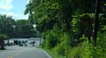
This is SR 664 leaving VA 72 south of Coeburn. Taken 8/1/08. |
|
|
This is VA 18 southbound in Covington. Regrettably the sun angle was bad. I don't know when Virginia stopped using this style of sign but I don't believe I've seen any others. Taken 8/30/08. |
|
|
This is SR 687 near Callison. Taken 8/30/08. |
|
|
This is on SR 624 (old VA 55) very near the red diamond sign on this gallery. Taken 10/23/08. |
|
|
This is SR 629 (old VA 212) in Brooke approaching SR 608. Taken 12/20/08. |
|
|
This is NB SR 601 a little north of US 17-50 on Mt. Weather. Taken 1/23/09. |
|
|
I couldn't get a good angle of this one on SR 605 at the Airlie Farm outside Warrenton. Taken 1/23/09. |
|
|
Front Royal still installs this style on new assemblies, but this is an older one. This is US 340-522/VA 55 NB Taken 10/23/08. |
|
|
WB Old Forest Rd (old VA 291) in Lynchburg. Taken 12/11/09. |
|
|
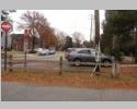
21st St in Hopewell Taken by Michael Elmore 4/7/11. |
|
|
US 58 WB just past Lovers Leap. Taken 2/13/09. |
|
|
I tried several times to get a good picture of this one located on the I-95 NB ramp to VA 195. Somebody finally did...which is good because this sign was finally replaced. Taken by Michael Elmore 5/21/11. |
|
|
US 220 Business SB in Rocky Mount. Taken 2/13/09. |
|
|
US 221 SB south of Dugspur. Taken 2/13/09. |
|
|
US 221 SB south of Dugspur near the Carroll County line. Taken 2/13/09. |
|
|
Located in Ettrick. Taken by Michael Elmore 4/26/11. |
|
|
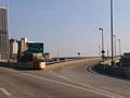
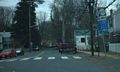
Paralleling I-64 EB just after the HRBT. This was once part of US 60 EB. Taken fall 2010. |
|
|
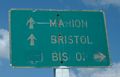
Old VA 76 EB in Bristol. Taken spring 2011. |
|
|
On VA 376 at the back part of campus. Taken 9/3/09. |
|
|
On SR 613 NB near US 340 Bentonville. Taken 6/5/10. |
|
|
Just off Pleasant Valley Rd east of I-81. Taken summer 2010. |
|
|
Neighborhood street off US 501 Bus in western Lynchburg. Taken 12/11/09. |
|
|
I believe this was on Grandin Rd WB between US 221 and US 11. Taken 12/11/09. |
|
|
Neighborhood street off US 501 Bus in western Lynchburg. Taken 12/11/09. |
|
|
Neighborhood street off US 501 Bus in western Lynchburg. Taken 12/11/09. |
|
|
SR 1005 just off US 52/VA 42 near I-77. Taken 2/13/09. |
|
|
SR 1001 just off US 52/VA 42 in Bland CH. Taken 2/13/09. |
|
|
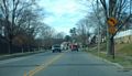
Grandin WB just past US 221 in Roanoke. Taken 12/11/09. |
|
|
US 501 Bus SB in Lynchburg. Taken 12/11/09. |
|
|
I believe this is SB US 11 in Roanoke. Taken 12/11/09. |
|
|
|
|
|
|
|
|
|
|
|
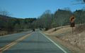
NB SR 758 (old VA 102) approaching the Blue Ridge Pkwy Taken 2/13/09. |
|
|
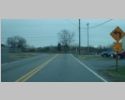
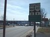
This is on VA 67 north approaching the US 460 Bypass in Richlands. This was probably one of the last written out versions of this sign to appear when the interchange was built in 1974. Taken 7/21/07. |
|
|
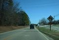
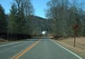
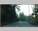
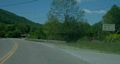
This is US 58 WB approaching Laurel Fork. Taken 1/21/09. |
|
|
|
|
|
This is the only one of this style sign I'd ever seen until 2011. This is on SR 606 (old VA 184) leaving Nassawadox. Taken 4/26/07. |
|
|
I finally found another one of these signs, on SR 645 WB leaving Abingdon Taken spring 2010. |
|
|
Lo and behold a 3rd example, on SR 679 WB leaving Greenbackville in Accomac County. Taken 12/3/11. |
|
|
Not many of these with the narrow font still around. This is on SR 641 near Stormont in Middlesex County. Taken 4/7/06. |
|
|
SR 659 off SR 651 west of Remington. Taken 9/2/10. |
|
|
SR 644 off US 1 Bus near Fredericksburg. The original distance numbers have fallen off. SR 644 is less than a half-mile long, not 2+ miles. Taken December 2011. |
|
|
This is on SR 658 in Widewater Beach, Stafford County. Taken 5/24/12. |
|
|
This is in Luray where VA 266 north used to breakaway. This was still there in early 2008. Taken 1/17/07. |
|
|
This old sign (above 645 shield) is in Clifton. Taken 11/26/08. |
|
|
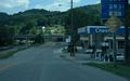
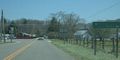
This is on US 460 Bus eastbound after VA 40. Blackstone is the only place I've seen this smaller style of the 3-destination mileage sign. Another used to be on VA 40 west leaving US 460 Business. Taken 2/15/08. |
|
|
Here is another ancient distance sign heading the other way into downtown Blackstone. Taken 2/15/08. |
|
|
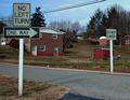
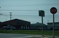
An older set of prohibition signs. This is at the exit of the Rocky Mount DMV office. Taken 12/8/07. |
|
|
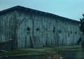
On a barn near the US 1-VA 208 intersection Four Mile Fork Taken December 2011. |
|
|
There were several of these along SR 601 near Craigsville. Taken summer 2010. |
|
|
This is on US 58 Bus WB approaching US 301 in Emporia. Taken 10/22/13. |
|
|
|
|
|
This is on VA 46 in Lawrenceville. Taken 1/21/08. |
|
|
SR 692 just off US 1 south of Ashland. Taken 1/7/12. |
|
|
This old speed limit assembly is on SR 681 (old VA 38) leaving VA 13 in Tobaccoville. Taken 2/15/08. |
|
|
This is on Business US 19-460 and VA 16 southbound approaching VA 16 ALT in Tazewell. It looks like the Bishop arrow used to be straight ahead as well but that would never have made any sense. Taken 7/21/07. |
|
|
This is at the west end of the US 460 Bus/VA 67 one-way splits in Richlands. I don't recall seeing this style sign anywhere else. Taken 8/18/07. |
|
|
This is SR 624 (old VA 55) at the eastern edge of the Front Royal CL. I have never seen a red diamond sign like this anywhere. Even odder is that the junction it references is extremely minor. Taken 10/23/08. |
|
|
SR 805 (old VA 95). I can't tell if this is an older VDOT sign or not (leaning towards not). Taken 1/21/09. |
|
|
A second example. Taken 1/21/09. |
|
|
This sign sits well off the edge of VA 30 west approaching US 1. This may be from when then the I-95 interchange was first opened. Taken 10/25/06. |
|
|
SR 614 at SR 616 in Gloucester County. Taken 10/19/10. |
|
|
This is on SR 600 approaching VA 202 Templemans. Taken 2/16/07. |
|
|
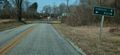
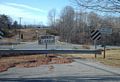
This is SR 749 (old VA 90) coming to an end at US 21. This was replaced by Jan 2009. Taken 4/13/07. |
|
|
SR 601/708 jct near Cox Chapel Taken 9/3/10. |
|
|
Baywood. Taken 2/13/09. |
|
|
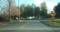
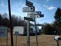
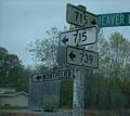
SR 729 (old VA 242) at SR 627 near Eggbornsville. Taken 9/2/10. |
|
|
From the other direction. Taken 9/2/10. |
|
|
This is on SR 695 (old VA 3) near White Stone. Taken 4/24/12. |
|
|
SR 657 at SR 650 (old US 58) near Thomas Store Taken 2/13/09. |
|
|
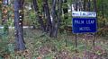
This white destination sign is at the old end of VA 51Y in Beaverdam. Taken 4/23/08. |
|
|
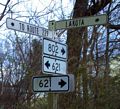
This is at the SR 802 (old VA 29) turn in Jeffersonton. Still present in January 2009. Taken 2/1/06. |
|
|
This is US 522 at SR 647 in Flint Hill. Taken 10/23/08. |
|
|
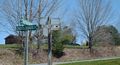
This reads "Jennings Creek Rd" and is at the SR 614-622 jct in Arcadia. Taken 12/5/08. |
|
|
This is where old VA 208 turned right heading west in Caroline County. Taken 12/20/08. |
|
|
|
|
|
|
|
|
|
|
|
This is on the US 460 frontage road underneath VA 61's New River bridge. Taken 3/10/07. |
|
|
|
|
|
This is VA 74 not far from its western end. Taken 5/24/08. |
|
|
Old routing of VA 24 in Stewartsville. Taken 12/11/09. |
|
|
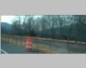
This is SR 616 just south of VA 22 near Keswick. These signs are not legible when driving by even at slow speeds. The bridge over the RR dates to the 1950s so I assume these signs are that old. Don't know if this is the style of VDOT at that time or a creation of the railroad owner. The weight limit now is only 3 tons, though. Taken 10/21/08. |
|
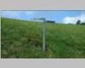
There was one sign like this on each end. Taken 10/21/08. |
|
|
The sun angle belies how old this sign looked in person. This is on SR 623 in the Rockbridge County Fredericksburg. Taken 12/5/08. |
|
|
This is SR 607 several blocks north of VA 83 in Clintwood. Taken 8/1/08. |
|
|
NB SR 1216 (old US 17) in Hayes. Taken 10/19/10. |
|
|
This is on VA 30 West Point just north of VA 33. I'm a little suspicious of this one...the mill may have Smurfed a modern sign with yellow paint. Taken 10/27/07. |
|
|
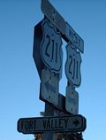
VA 91 SB outside Saltville. The tracks are gone but the sign remains. Taken 2/13/09. |
|
|
US 460 Bus WB. US 460 and now US 460 Bus have always followed the ramp to the right so I don't know why there is no shield on the Crater Rd BGS. Taken by Michael Elmore 11/30/11. |
|
|
|
|
|
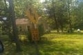
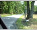
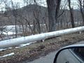
OK not a sign but here is some decades-old railing alongside WB I-64 west of Clifton Forge. This probably dates back to when this was US 60-220 only. Taken summer 2010. |
|
|
Another example of this kind of rail, which I believe was in use in the 40s-50s. This is on a neighborhood street in Iron Gate. Taken 1/11/10. |
Return to Old Signs main page.
![]()
![]()
Page last modified 5 November 2016
(C) 2017-2008 Mike Roberson, Adam Froehlig