| Virginia Highways
Project Abandoned Bridges of Virginia |
This gallery is dedicated to bridges that were abandoned and are mostly intact...
Last update (1/28/12): Debut of page
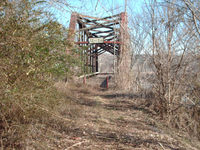
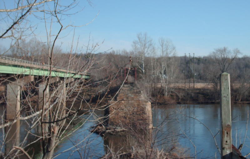
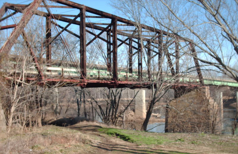
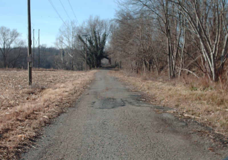
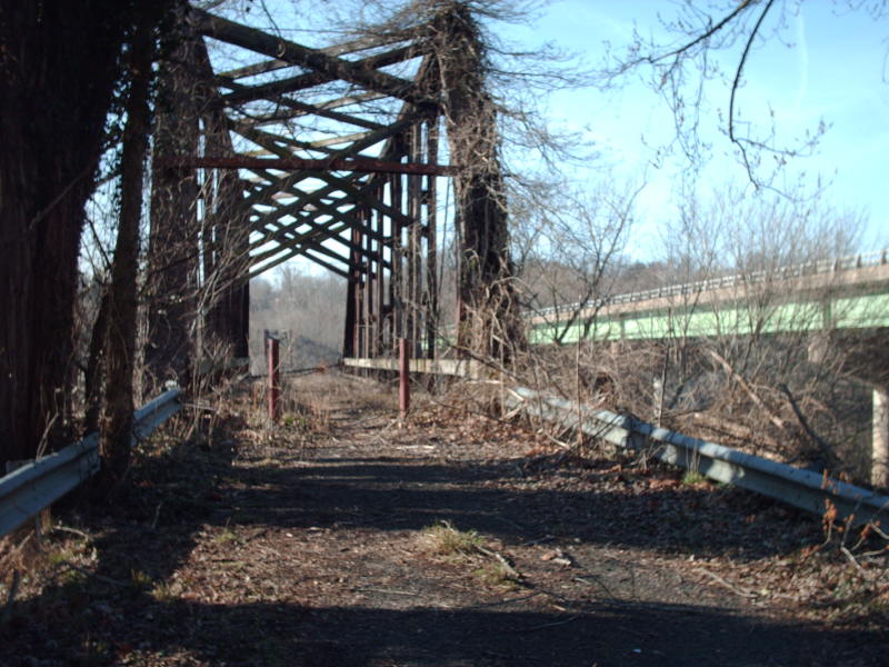
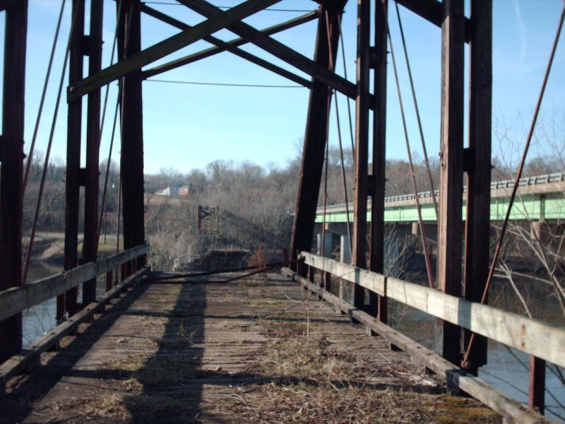
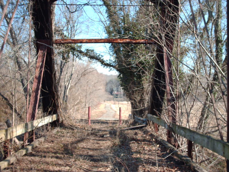
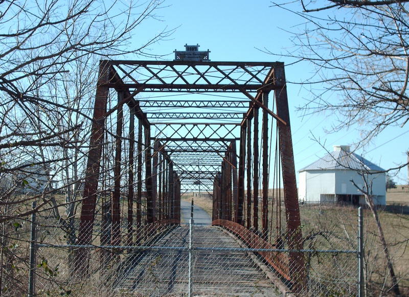
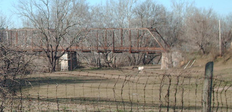
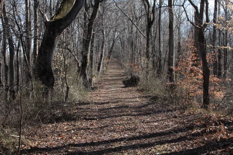
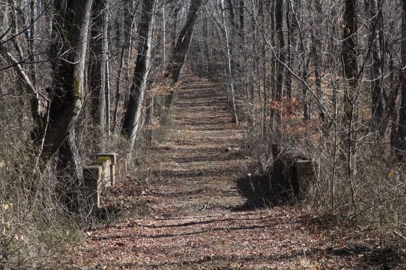
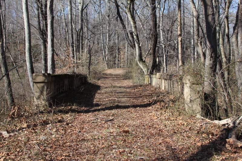
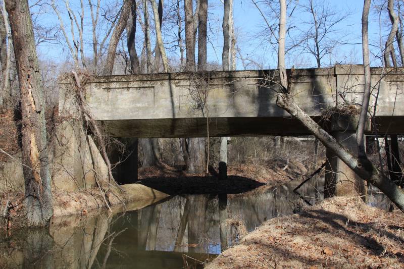
Location:VA 45 over James River, Cartersville
Notes: Built in 1884, this bridge was placed in the primary system in August 1928 as VA 45 which it remained until Hurricane Agnes washed the center away in 1972. The bridge had already survived Hurricane Camille putting the river two feet above the roadway 3 years earlier. VDOT wanted to tear the remnants down but Cumberland and Goochland Counties wanted the bridge preserved as a historic structure. It looks like nothing has been done with the bridge.
This information including the date the bridge was built came from the Cumberland County Historical Sites website.
The bridge had a wood deck with a thin layer of asphalt. This bridge was extremely narrow and underneath the deck were very thin layers of metal. The truss superstructure is wood. The modern bridge is dated 1973.
The first 4 pictures are from the north side of the river and the second four are on the south.
Photos: (by Mapmikey 1/21/08)
 |
 |
 |
 |
 |
 |
 |
 |
Location:SR 769 over Smith River, Mt. Meridian
Notes: Built in 1897, this bridge is now closed but I don't think for very many years. It was briefly been part of VA 256 but mostly it has always been secondary.
Photos: (by Mapmikey 1/17/07)
 |
 |
 |
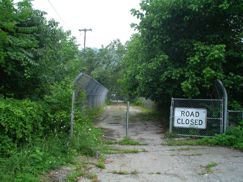
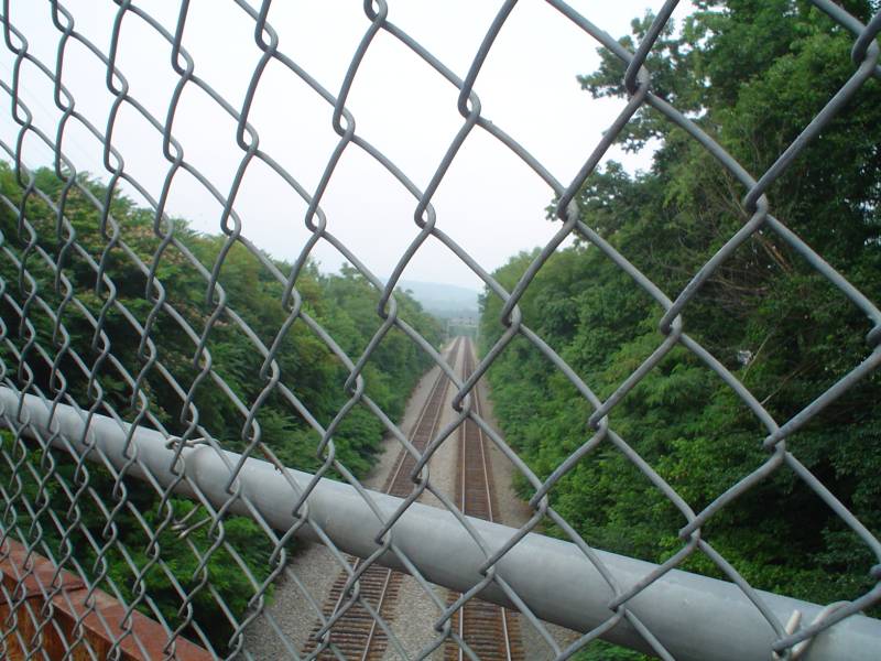
Location:US 11-460 over the railroad, Elliston
Notes: Not sure when this was built; this bridge was closed around 1997 when the NB route of US 11-460 was moved to be right next to the SB route. For years they were separated by a fair distance through Elliston. Driveable road to near the bridge is now SR 603.
Photos: (by Chris E, August 2005)
 |
 |
 |
 |
 |
|
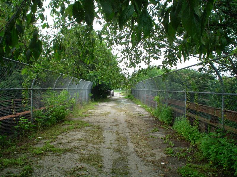
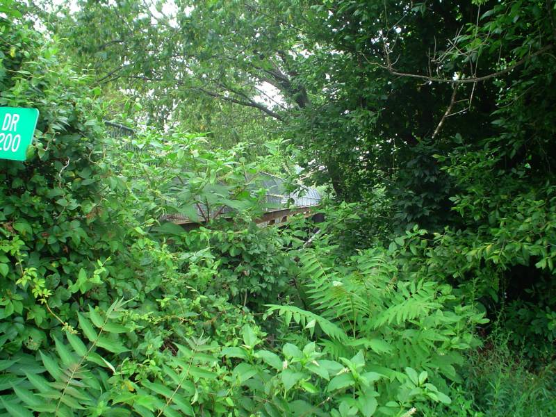
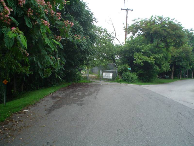
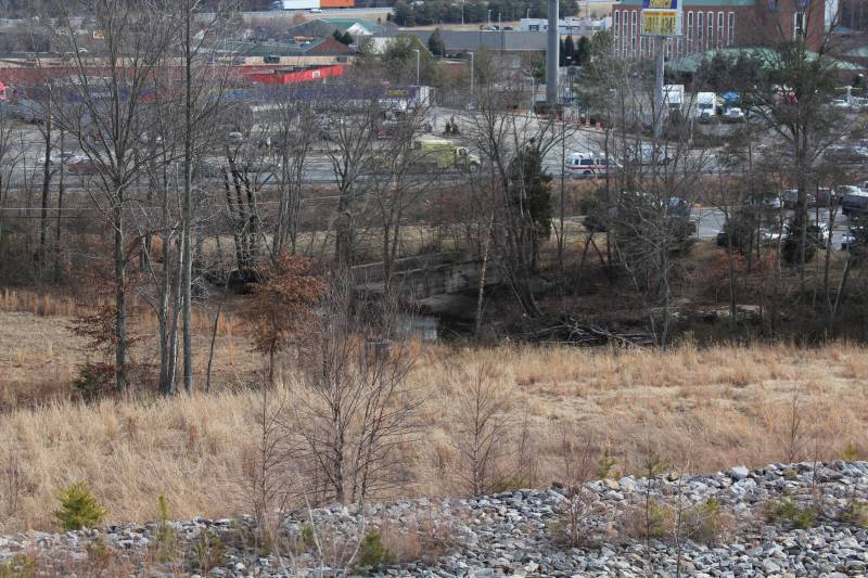
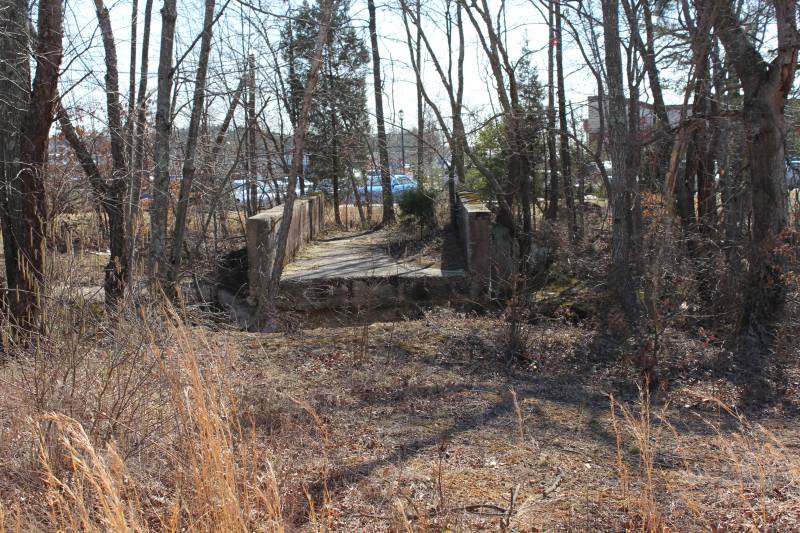
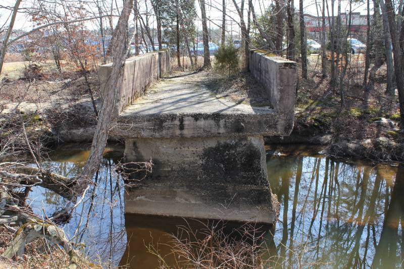
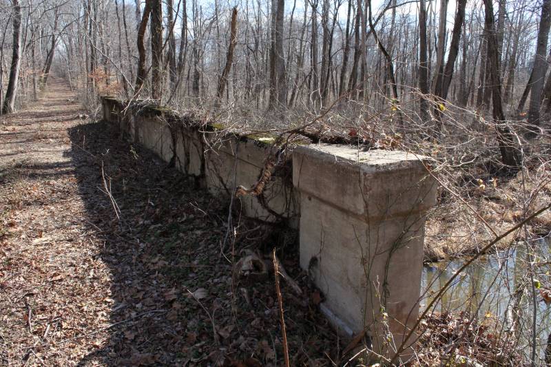
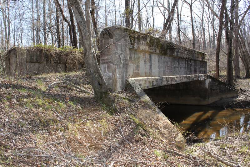
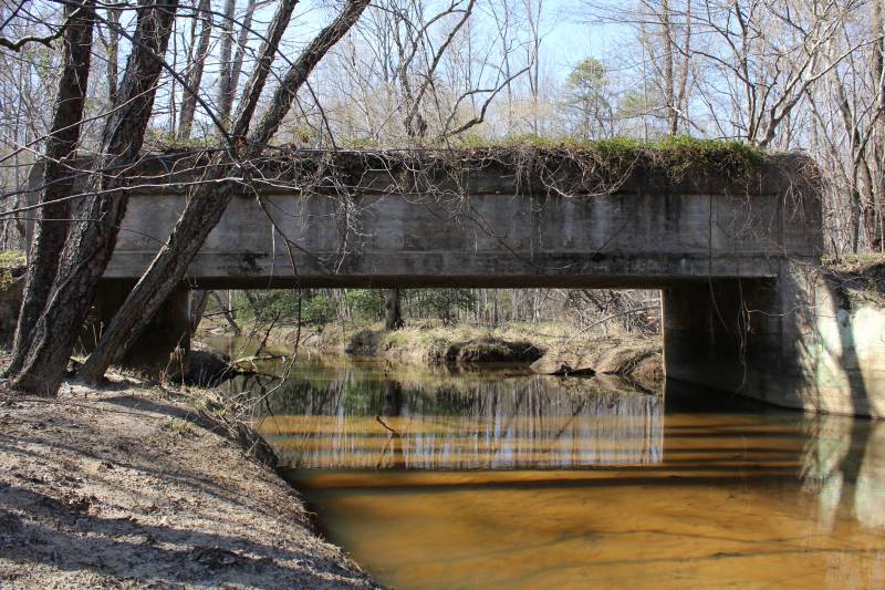
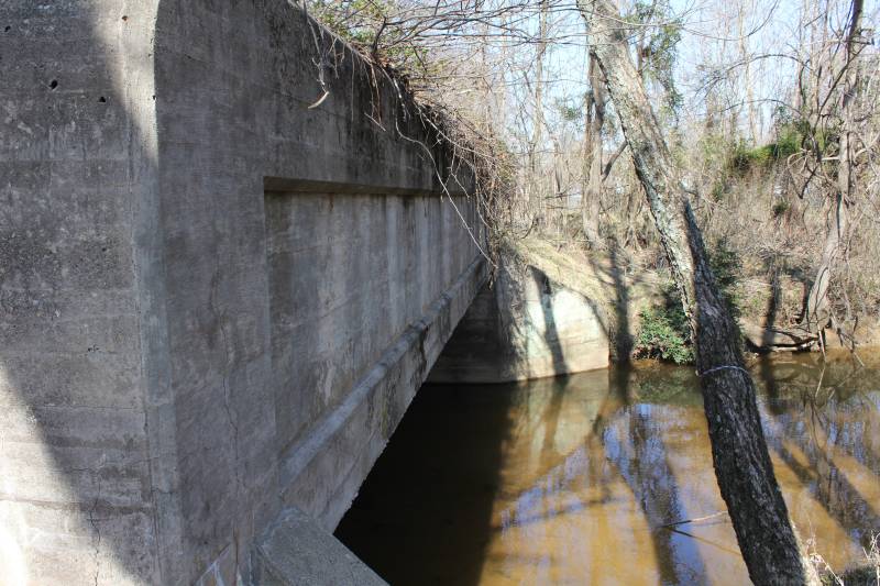
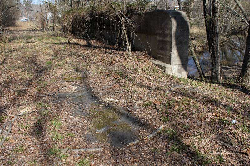
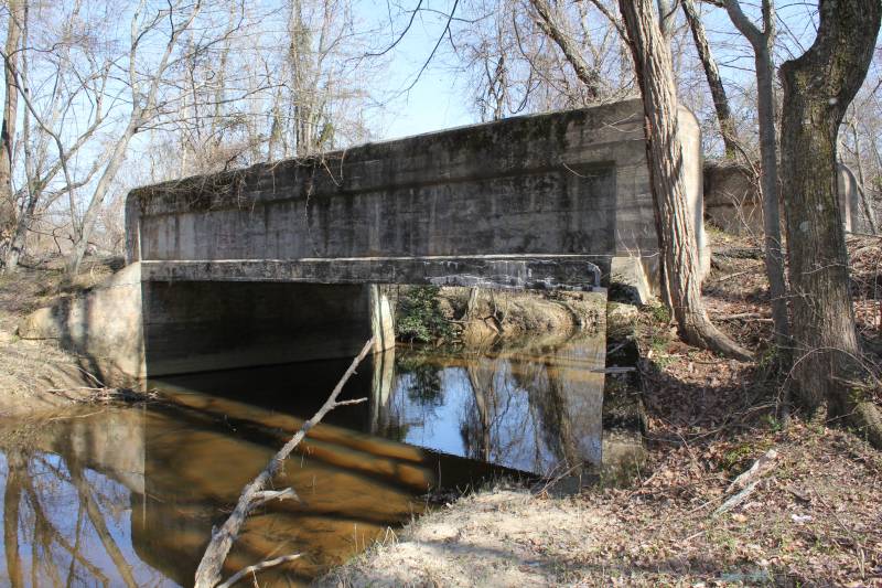
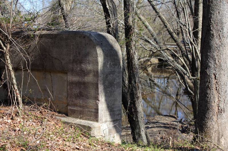
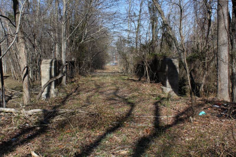
Location:off US 1, Massaponax Creek near Fredericksburg
Notes: This is shown on the 1958 Spotsylvania County map as still in service as part of SR 636, probably was abandoned when I-95 was built thorugh here in early 60s. Pretty sure US 1 never used it though. The Ni and Po River Bridges are dated 1926 (the current Massaponax Bridge is dated 1978 when it was widened). I cannot really accurately put a date on when the abandoned bridge was built. Concrete bridges like that go back to at least the mid-1910s. I have found only two that had dates on them, 1917 and 1924. The CTB minutes were no help because it was not in the primary system (old VA 1 and VA 31 initially used VA 208/SR 738 to come up from Richmond). This bridge is just off the parking lot of a fast-food establishment and is easy seen/accessed |
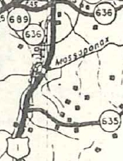
SR 636 over Massaponax Cr. SR 635 is partially part of US 17 now 1958 Spotsylvania County |
Photos: (by Vaconcreteman 1/24/11 and 2/23/11)
 |
 |
 |
 |
 |
 |
 |
 |
 |
 |
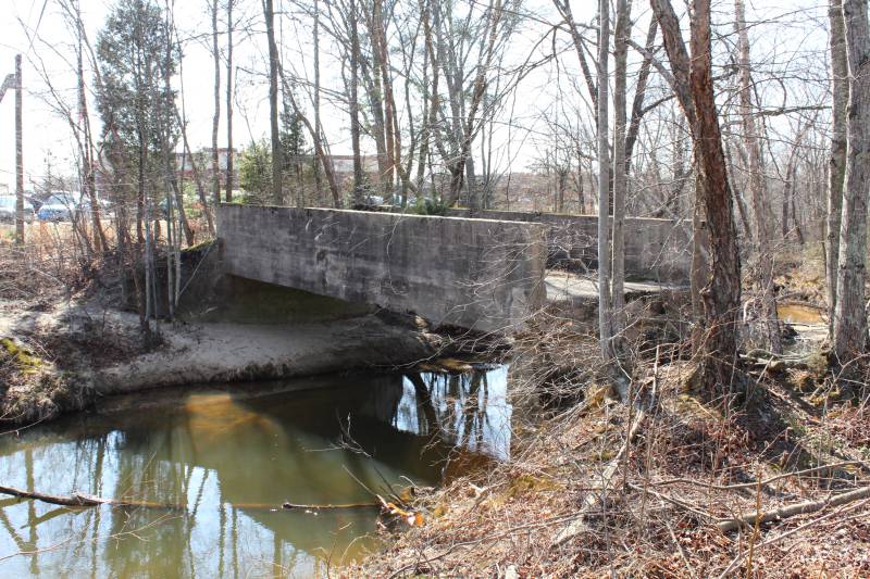 |
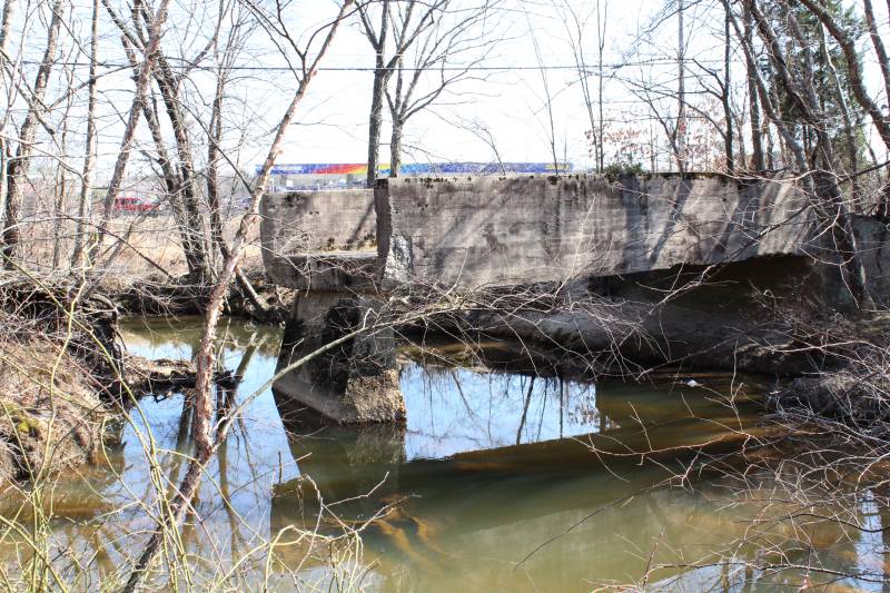
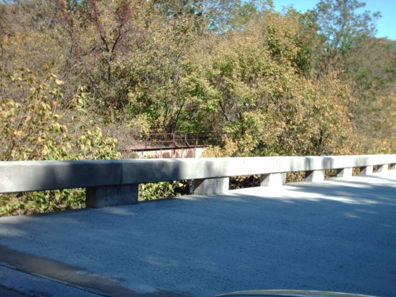
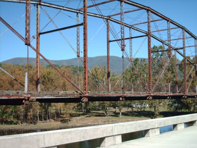
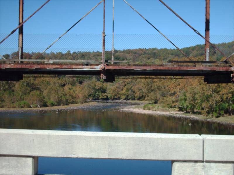
Location:VA 3 over Lambs Creek, near King George C.H.
Notes: Unclear when it was built but likely before 1926, this bridge was the original routing of VA 7 and/or VA 37. In Oct 1933 (CTB) a contract was awarded to work on VA 3 from east of Popcastle Cr to west of Birchwood Cr. Looking at the 1932 and 1936 King George County maps closely, VA 3 was definitely altered there. It used to run up what is now SR 694 to the church around the first bend then angle back southwest over abandoned alignment to current 3. So I think the old bridge was abandoned in this timeframe.
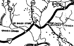
old VA 37 over Lambs Cr. CR 2 is now SR 607; CR 106 is now SR 694 1932 King George County |
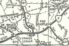
VA 3 over Lambs Cr. (labeled Popcastle Cr) SR 607 north of VA 3 is now SR 694 1958 King George County |
The bridge is physically to the south of current VA 3 and is easily visible.
Photos: (by Vaconcreteman 2/5/11)
 |
 |
 |
 |
 |
 |
 |
 |
 |
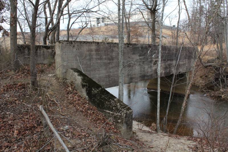
Location:US 1 over Accokeek Creek, near Stafford C.H.
Notes: Unclear when it was built but likely before 1926, this bridge was the original routing of VA 1 and was still in use when US 1 was commissioned. The current US 1 bridge was built in 1933 with this original bridge abandoned then.
This one is harder to see when it is not winter and is also adjacent to the Rappahannock Regional Jail. The old alignment north of the bridge is hard to make out unless it has snowed.
The bridge is physically to the west of US 1.
Photos: (by Vaconcreteman 3/29/11)
 |
 |
 |
 |
 |
 |
 |
 |
 |
|
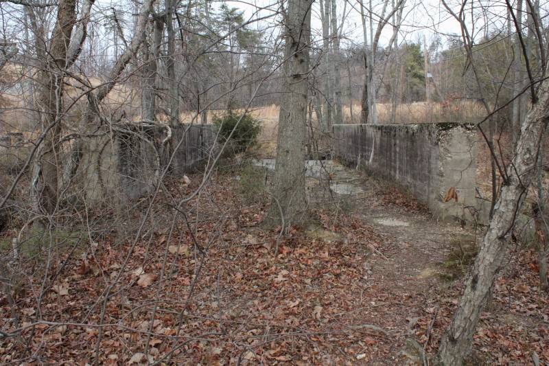
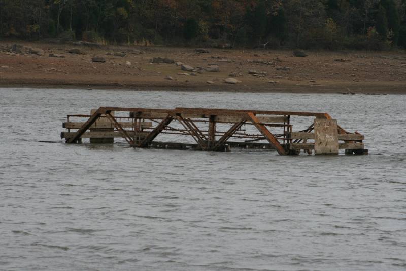
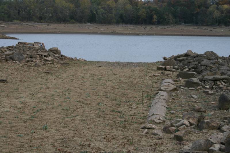
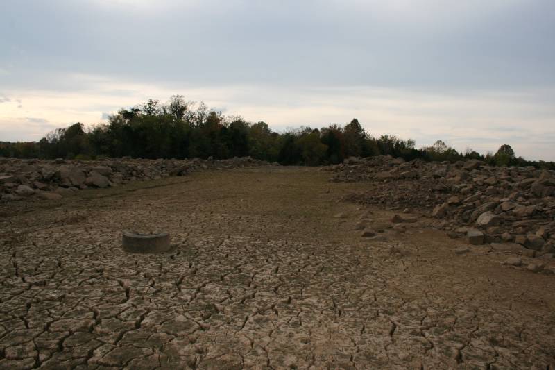
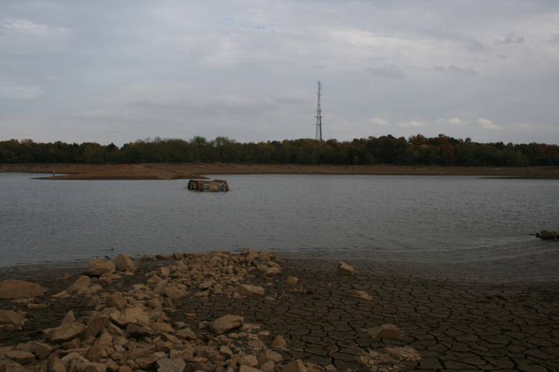
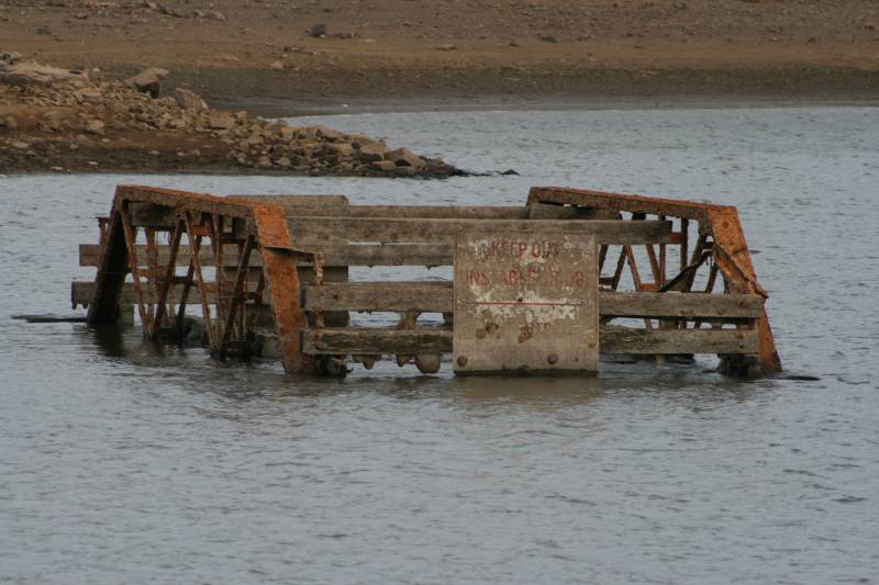
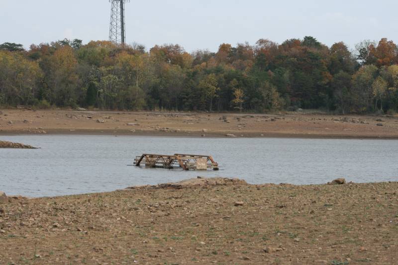
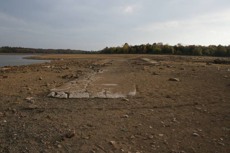
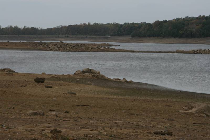
Location:old SR 625 over Beaverdam Creek, north of Arcola (Loudoun County).
Notes: Unclear when it was built; this bridge was abandoned when the reservoir was created in the 1960s (?). From Vaconcreteman: I do not know what year the reservoir was created but I remember fishing there in the mid seventies. Sometime in the 60's if I had to guess. Rt 659 Belmont Ridge rd runs north and south to the East. Rt. 621 Evergreen Mill rd runs North and South to the West. Reservoir rd (now SR 861) runs East to the current reservoir and stops. Mt. Hope road is on the other side and this road used to be connected. This bridge was submerged when the reservoir was filled years ago but the bridge becomes visible during a severe drought. The pictures I took were on 10/23/2007 which was the last day before it started to rain. The old road bed is visible as are the remains of the foundation of a long lost home. |
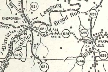
SR 625 over Beaverdam Cr. (not labeled, just west of Waxpool) 1958 Loudoun County |
Photos: (by Vaconcreteman 10/23/07)
 |
 |
 |
 |
 |
 |
 |
 |
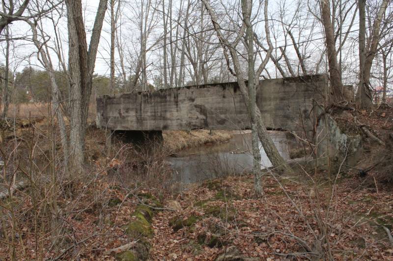
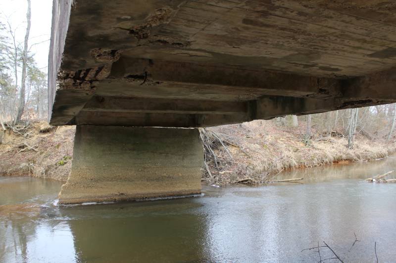
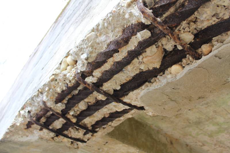
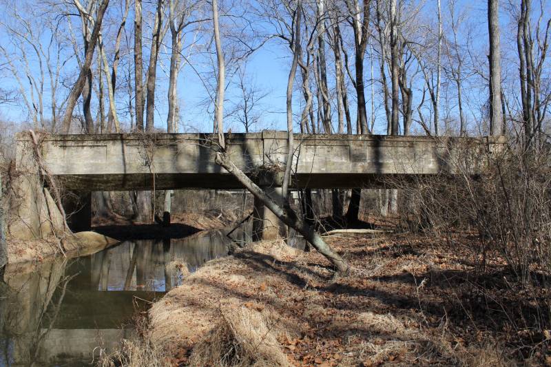
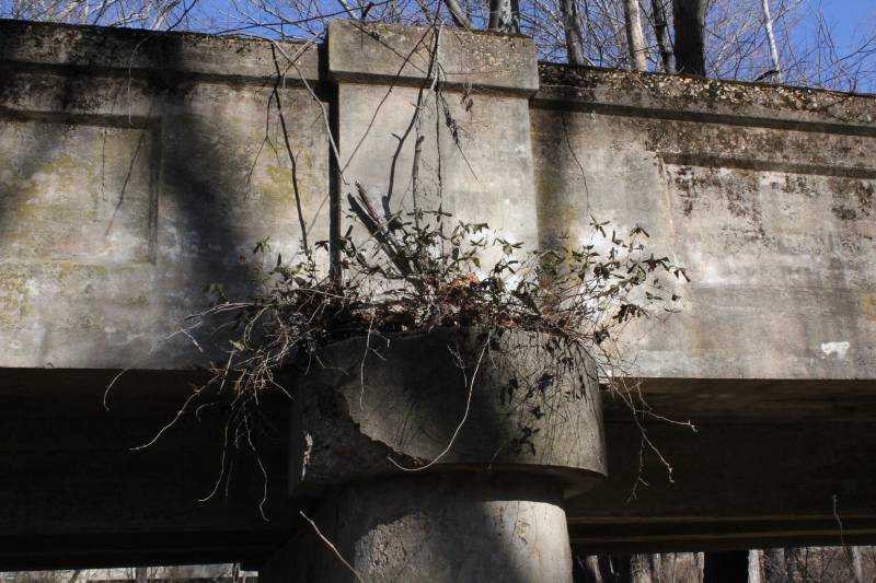
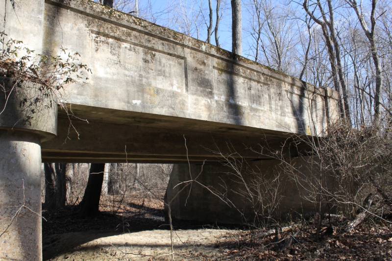
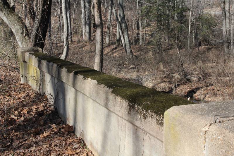
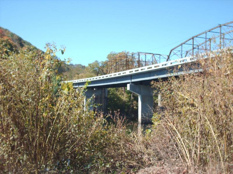
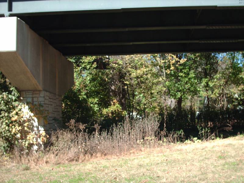
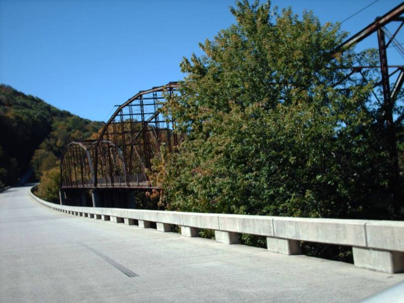
Location:SR 623 over New River, Pembroke.
Notes: Unclear when it was built; the current bridge was built in 1996.
From the pictures you can see that the supports were substantial (big concrete piers) even though the structure of the bridge looks a little waifish. It is hard to see in the second underneath photo but the old bridge is no longer complete on this end (east end).
Photos: (by Mapmikey 10/8/10)
 |
 |
 |
 |
 |
 |
 |
Page last modified 28 January 2012