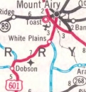
U.S. 601
< 521 | Home | 601 Bus | 701 >
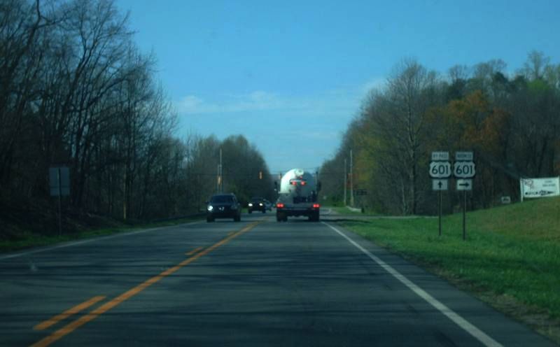
Photo: US 601 at the Dobson Bypass (Mapmikey)
| U.S. 601 132 miles | |||
| The Road: |
Begins at the South Carolina State line below Monroe (Union County) and ends at US 52 Mt. Airy (Surry County).
Nationally US 601 runs from Mt. Airy to US 321 near Pineland, SC. |
Towns and Attractions: | Macon Co.: Franklin
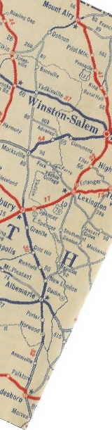
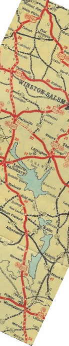
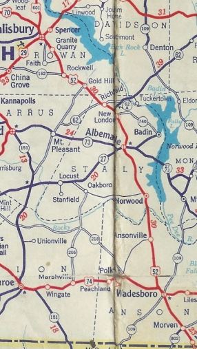
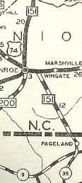
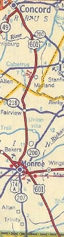
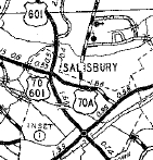
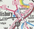
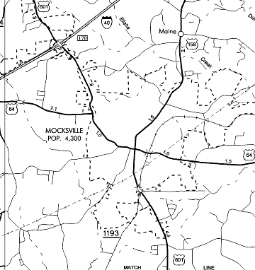
Union Co.: Monroe Cabarrus Co.: Concord Rowan Co.: Salisbury Davie Co.: Mocksville Yadkin Co.: Yadkinville, Boonville Surry Co.: Dobson, Mt. Airy |
History: |
US 601 was an original US Highway that did not come to North Carolina until 1932 when it was extended north from Cheraw, SC. It was added to NC 80 from the SC Line through Morven, Wadesboro, Albemarle, Salisbury, Mocksville, and Yadkinville, before ending at US 121/NC 66 in Mt. Airy.
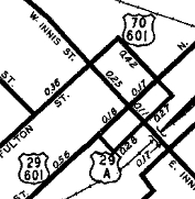
In late 1934, US 601 south was truncated to US 29-52-70/NC 150 Main St. Salisbury. Salisbury southeast to South Carolina towards Cheraw became part of US 52. The old 601 routing approximately used: today's US 52 to Morven, then used "Old US 52" northward, picked up 52 again but veered northwest on SR 1131 Morven Rd to Wadesboro where it cut west on Morgan St to NC 109. US 52 used US 74 west from NC 109 then current 52 north to Cedar Hill. US 601 used Pinkston-River Rd from Cedar Hill to Rocky River. In Stanly County, US 601 may have briefly used Riverside Rd and Pee Dee St to Norwood. US 601 then used current US 52 then old US 52 (S. 2nd St) to Albemarle, then used today's US 52 Bus. North of Albemarle 601 used current 52, then Main St and SR 1632 through New London. US 601 followed current 52 to Misenheimer, then may have briefly used Glenmore Rd/Old Route 80 to Gold Hill. US 601 then followed current 52 to I-85, then Innis St into Salisbury.
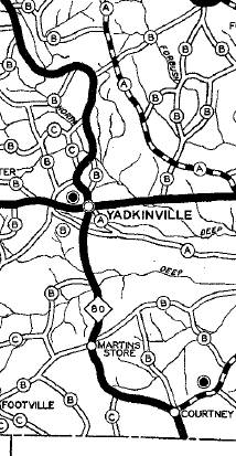
In 1936, US 601 was removed from SR 1502/1503 Country Club Rd north of Yadkinville. In 1937 or 1938, US 601 was removed from Pleasant Acre Dr in southern Davie County. Also in this timeframe, US 601 was removed from SR 1002 Liberty Church Rd and SR 1332 Elmore Rd loop in northern Davie County. Also in 1937 or 1938, US 601 was removed from a bit of NC 801; SR 1425 Four Corners Rd; SR 1725 Ray Moore Rd to Courtney; SR 1001 Courtney Rd; SR 1165 Fish Brandon Rd to Martins Store; SR 1002 Lone Hickory Rd.
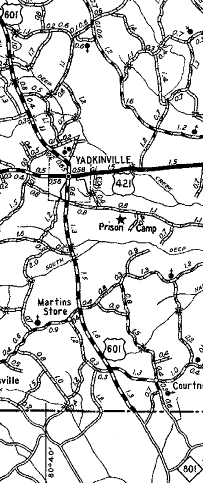
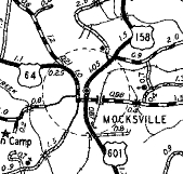
Also in 1937 or 1938, US 601 was rerouted in Mocksville to leave Main St via Depot St to Salisbury St instead of using Gaither St to Salisbury St. The portion of Main St between Depot and Gaither Sts became an extended US 158.
Between 1939-44, US 601 was removed from the Ephesus loop road. Also between 1939-44, US 601 was removed from SR 1104 Cody Tr south of Dobson and from SR 1355 Mason Rd/2216 Fireside Ln loops in the Turner Mountain area near White Plains. Between 1945-49, US 601 was rerouted in Mocksville to leave Main St via Sanford Ave to Salisbury St instead of using Depot St to Salisbury St. The portion of Main St between Sanford and Depot Sts became an extended US 158. Also between 1945-49, US 601 was removed from SR 1365/2001 Forrest Dr loops just south of today's US 52 Mt. Airy Bypass. In 1952, US 601 was extended south with US 29 to Concord, then replaced NC 151 south through Monroe (placed on current US 74 around Monroe) to South Carolina heading for Pageland, SC and beyond.
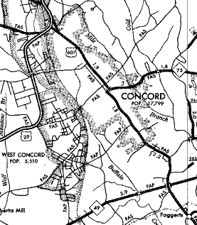
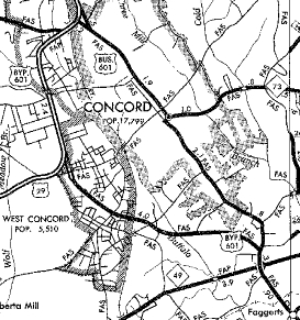
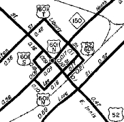
About 1953, US 601 was rerouted in Salisbury to use Fulton St and Liberty St to get from innis to Main. Around 1954, US 601 was again rerouted in Salisbury onto one-way splits: NB left Main St by going south on Bank St then east on Lee St then north on Innis. SB left Innis on Church St west to Fisher St south to Main. The old route using Fulton/Liberty became US 601 Truck while US 601's NB routing replaced a US 29-A routing. Between 1954-57, US 601 was removed from SR 1150 Old Monroe Cir and SR 2631 Fairbluff Rd south of Faggerts. In Oct 1965 (NCDOT), US 601 was placed on new construction south of Concord, then added to US 29 around the west of Concord. The old route through Concord became US 601 Business (today this is a bit of NC 3; S. Union St, and NC 73).
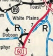
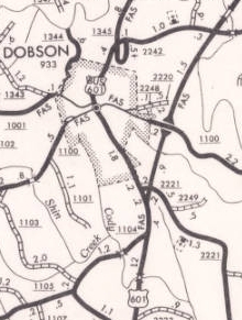
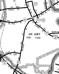
In Sept 1970 (NCDOT), US 601 was placed on new construction bypassing Dobson and White Plains to nearly Mt. Airy. This left behind US 601 Business and a lengthy Old US 601.
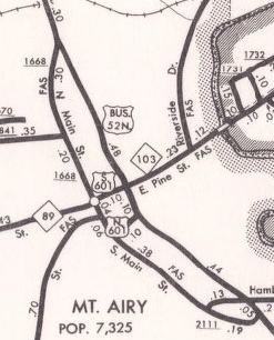
In Oct 1970 (NCDOT), US 601 was given split routing in Mt. Airy. NB went south on Main then east on Cherry to end at US 52 Bus in Renfro. SB began by leaving Renfro along Pine St then south on Main St to Rockford. In May 1981 (NCDOT), US 601 was removed from central Salisbury and placed onto Jake Alexander Blvd from US 29 northward. Main St remained US 29 and Innis St along with the split alignments all became non-primary.
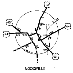
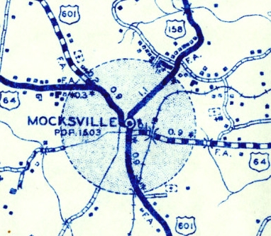
In Jan 1988 (NCDOT), US 601 was removed from US 29 between NC 152 and Salisbury and instead was added to the I-85 Connector and I-85 north to Jake Alexander Blvd, then along Jake Alexander Blvd north to the existing Salisbury bypass. In Jan 1991 (NCDOT), US 601 was removed from Salisbury St, Wilkesboro St, and Yadkin Rd in Mocksville and moved to the Valley Rd alignment around the west of central Mocksville. The old streets all became secondary.
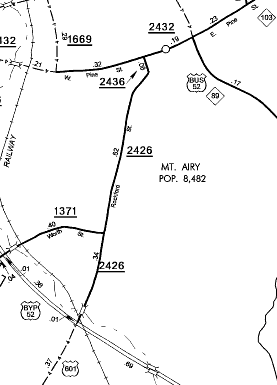
In March 1995 (NCDOT), US 601's one-way splits were removed in Mt. Airy. US 601 left Rockford via Dixie St north to NC 89 Pine St then east to what had been the US 601 SB beginning at US 52 Business Renfro. All of what had been the NB split became secondary. In May 1996 (NCDOT), US 601 was removed from US 29 between North Concord and China Grove and instead routed onto more I-85. In June 1999 (NCDOT), US 601 north was truncated to the US 52 Bypass of Mt. Airy leaving behind secondary routing.
|
Comments: |
US 601 is not a major corridor in North Carolina (nor South Carolina for that matter).
US 601 was only 68 miles long nationally between 1935-52. The necessity for an interchange on the Dobson Bypass escapes me. |