N.C. 160
< 159 | Home | 161 >
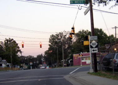
Photo: NC 160's beginning from northbound NC 49 (Chris Patriarca)
| N.C. 160 14 miles | |||
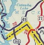
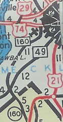
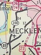
| The Road: | Begins at NC 49 in Charlotte and ends when it drops into South Carolina, all within Mecklenburg County. The route continues 11 miles as SC 160 to US 521 east of Fort Mill, SC. | Towns and Attractions: | Mecklenburg Co: Charlotte | History: |
NC 160 appears to have been designated about 1942 as a newly numbered route from NC 49 south a mile to the Palmetto State. The South Carolina side was present at the state line (as SC 211) in 1939 but maps seem to show NC did not make their side primary until SC renumbered SC 211 to SC 160 about 1942.
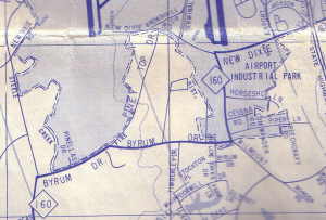
Between 1956-58, NC 160 was extended north as new primary routing to US 29-74 Wilkninson Blvd. In 1967, NC 160 was rerouted at the airport to head east to Tryon St, NC 49, leaving behind Morris Field Dr.
|
Comment: | NC 160 is multilane from Horseshoe Ln (SE of airport) eastward. |
Last Update: 18 June 2007
Previous: N.C. 159 |
Next: N.C. 161
Top | NCRoads.com
Home