N.C. 104
< 103 | Home | 105 >
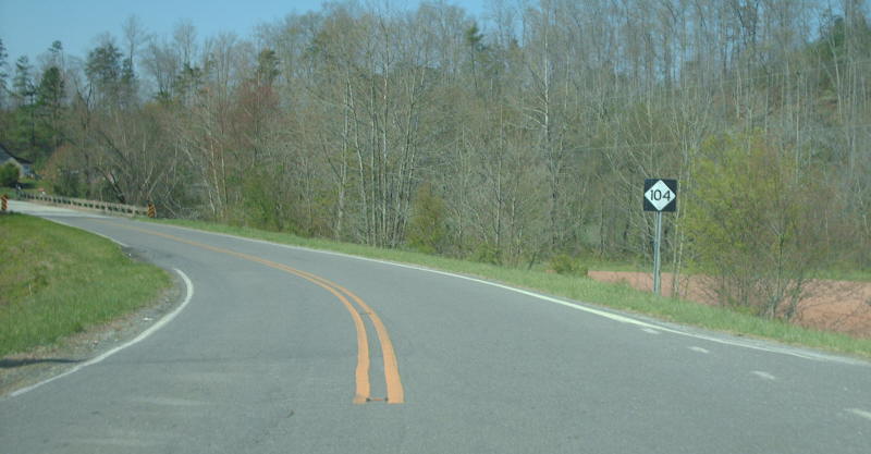
Photo: NC 104 leaving Virginia state line (Mapmikey)
| N.C. 104 6 miles | |||
| The Road: | Begins at NC 103 Mt. Airy and ends at the Virginia State Line nearby, all within Surry County. The Virginia side is no longer a primary route. | Towns and Attractions: |
Surry Co: Mt. Airy |
History: |
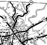
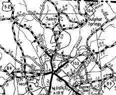
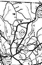
NC 104 was born in late 1940 as a renumbering of NC 800. This is the second NC 104.
Initially, NC 104 began at US 52 Main St at Lebanon and used Springs Rd northeast to current NC 104 and on to Virginia where the route became VA 104. Between 1954-57, NC 104 was rerouted to end at NC 103 as it does today. It appears this was new construction.
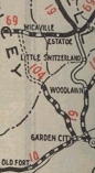
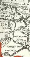
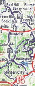
NC 104 #1 appears to be an original state highway - it appears on the 1921, 1922, and 1925 Officials but not the 1924 Official for some reason. It also appears on Rand McN maps in 1922. It ran from NC 10 (now SR 1214 Old NC 10) Pleasant Gardens northwest to NC 69 (now SR 1186) Micaville.
|
Comment: | NC 104 is posted sans direction banner outside the city of Mt. Airy. |
Last Update: 5 June 2009
Previous: N.C. 103 |
Next: N.C. 105
Top | NCRoads.com
Home