N.C. 67
< 66 | Home | 68 >
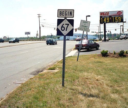
Photo: NC 67 leaving NC 150 (Mark Clifton)
| N.C. 67 40 miles | |||
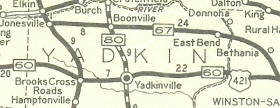
| The Road: | Begins at US 21 Business Jonesville (Yadkin County) and ends at NC 150 Winston-Salem (Forsyth County) | Towns and Attractions: | Yadkin Co.: Jonesville, Boonville, East Bend
Forsyth Co.: Winston-Salem |
History: |
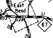
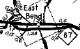
NC 67 was born in as a new primary route. Ran from US 21/NC 26 Jonesville to US 421/NC 60 (now SR 1525 Old Yadkinville Rd) Oldtown. However, it used not very much of today's NC 67. Instead it used Mayberry/Eck Rds (cutoff by I-77 now); Woodruff Rd west of Boonville; Charity Church Rd through Nebo and Mt. Pleasant; Mt Pleasant/Baltimore Church/Smithtown Rds to Smithtown; Fairground Rd to East Bend; "Old NC 67" through East Bend. in Forsyth County, it used Littlefield Rd (some now abandoned); Waller Rd and Vienna Dozier Rd; Seward Circle; Bethania and N. Causeway Rds through Bethania.
About 1933, NC 67 was given its much straighter alignment from Jonesville to then-US 421.
Between 1950-53, NC 67 was rebuilt around the south of East Bend, leaving behind SR 1545, "Old NC 67."
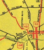
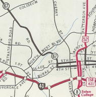
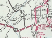
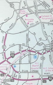
About 1961, NC 67 was extended into central Winston-Salem replacing US 421. It ran down Reynolda Rd, West End Blvd and Broad St then used one-way splits on 4th-5th over to US 158 Business (used one-way splits on Cherry-Marshall). The '63 Official shows NC 67 running to US 52/NC 8 but the '62 Forsyth County map shows US 158 Business in place. I believe the Official map is in error here. In 1970, NC 67 was removed off 4th/5th and instead continued south on Broad St to end at I-40 (now I-40 Bus). In 1994, NC 67 was removed from the Reynolda routing to central W-S and instead was placed on the Silas Creek Pkwy (present since the 60s) all the way around to NC 150 as it runs now.
|
Comments: |
Today's NC 67 serves as a direct alternative from the Jonesville/Elkin area to the northern parts of Winston-Salem. |


Last Update: 24 August 2008
Previous: N.C. 66 |
Next: N.C. 68
Top | NCRoads.com
Home