N.C. 65
< 64 | Home | 66 >
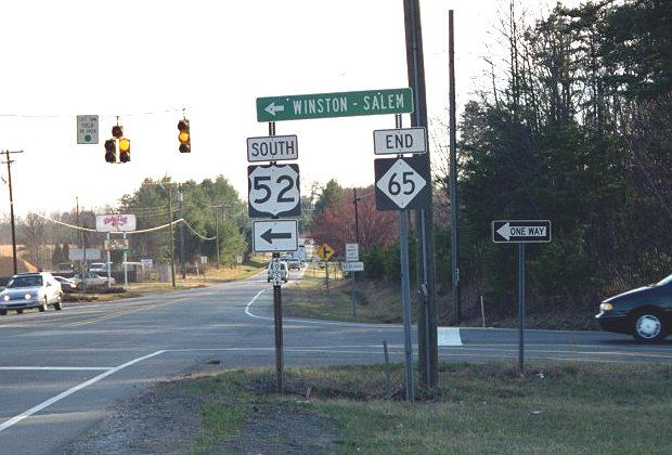
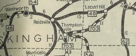
Photo: NC 65 at its present US 52 endpoint (Mark Clifton)
| N.C. 65 47 miles | |||
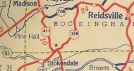
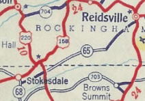
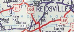
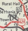
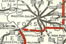
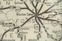
| The Road: | Begins at US 52 Rural Hall (Forsyth County) and ends at US 29 Bus-US 158-NC 87 Reidsville (Rockingham County) | Towns and Attractions: | Forsyth Co.: Rural Hall
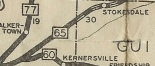
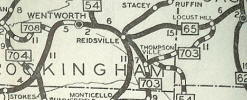
Stokes Co.: Walnut Cove Forsythe Co.: None Guilford Co.: Stokesdale Rockingham Co.: Reidsville |
History: |
NC 65 was born in 1934 as new primary routing. Ran at least from NC 66 Rural Hall east to US 158/NC 48 Stokesdale. The 1934 map I have is vague whether 65 ran west of Rural Hall.
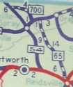
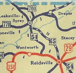
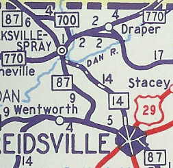
In 1935, NC 65 was extended northeast as new primary routing directly to Reidsville, then extended northwest as new primary routing to end at NC 700-770 Leaksville-Spray (now Eden). NC 65 used today's Scales St and a bit of NC 14, then Harrisons Cross Roads Rd, another bit of NC 14, then Bethlehem Church Rd. Just after today's US 311/NC 87-770, NC 65 cut northeast on Mebane Bridge Rd across the Dan River, then it looks like modern NC 14-87-770 destroyed some of the route, but it used Pearce St to connect with today's NC 700-770. By 1936, NC 65 was extended west as new routing to end at US 421 (now just Yadkinville Rd) Pfafftown. In 1937, the north end of NC 65 was shifted to NC 54 (now NC 87) south of Eden by staying on Bethlehem Church Rd.
In 1941, NC 65 and US 158 swapped routings between Stokesdale and Reidsville. Also, NC 65 from Reidsville to Eden became NC 14. NC 65 now ended at Harrison at Scales in downtown Reidsville.
In 1958, official maps started showing NC 65 west as truncated to NC 67 Bethania, leaving behind SR 3210. However, county atlases through at least 1968 showed NC 65 ending at SR 1525 Old Yadkinville Rd. In 1974, NC 65 east was truncated 1 block to US 158 S. Main St. Between 1980-82, US 158 was removed from Reidsville, so NC 65 may have been truncated to its current end then. However, NC 87 continued to run through Reidsville until 2000 so it is vague if 65 still followed 87 into downtown until then or not. In 2000, NC 65 west was truncated again, to US 52 near Rural Hall, leaving behind SR 1611 and SR 4002.
|
Comments: |
Today's NC 65 doesn't have much purpose if you ask me as it is surrounded by other corridors. |


Last Update: 23 August 2008
Previous: N.C. 64 |
Next: N.C. 66
Top | NCRoads.com
Home