N.C. 12
< 11 | Home | 13 >
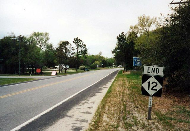
Photo: NC 12 ending (Alex Nitzman)
| N.C. 12 125 road miles | |||
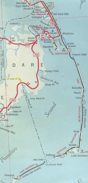
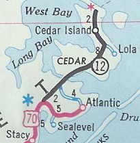
| The Road: | Begins at US 70 near Sea Level (Carteret County) and ends at the village of Corolla (Dare County) | Towns and Attractions: | Carteret Co: Cedar Island Nat'l Wildlife Refuge
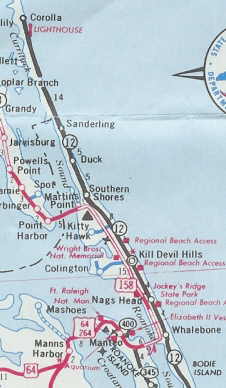
Hyde Co: Ocracoke Dare Co: Cape Hatteras, NC Outer Banks, Nags Head, Kill Devil Hills, Duck, Corolla |
History: |
NC 12 was born March 1963 (NCDOT) following the completion of the Bonner Bridge. NC 12 ran from US 158 Business Whalebone south to Hatteras (replacing SR 1001), then a ferry across Hatteras Inlet, then west to the village of Ocracoke (replacing SR 1323). This was new primary routing and the 2nd NC 12.
In 1976, NC 12 was extended across the sound to the mainland to connect with US 70. The Cedar Island side had a road for a number of years (SRs 1409 and 1387) before it became NC 12.
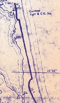
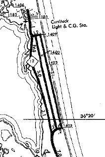
In July 1987 (NCDOT), NC 12 was extended north replacing US 158 Business and then as new primary routing up to Corolla. This replaced SRs 1200 and 1400. NC 12's endpoint was defined as 0.3 miles north of SR 1185. In Dec 1988 (NCDOT), NC 12 was removed from SR 1402 Albacore, SR 1400 Corolla and SR 1409 Shad Sts in Corolla. In May 1989 (NCDOT), NC 12 was removed from today's Pelican Watch Way and abandoned routing and placed on its modern configuration near US 158 in Kitty Hawk. NC 12 absorbed SR 1203 in the process.
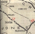
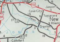
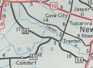
The first NC 12 was an original state highway. It initially began at NC 10-11 (today's US 70-258 Bus, NC 11-55) Kinston, running to Snow Hill via Hookerton, Farmville, Tarboro, Scotland Neck via Speed and Hobgood; then northwest to end at NC 40 (current US 301) near Halifax.
In 1927, NC 12 was extended through Murfreesboro, then north to the Virginia Line (becoming VA 108), replacing NC 485. Also in 1927, US 117 was added to the northern few miles of NC 12.
|
Comment: |
NC 12 connects the villages of the Outer Banks to one another. In some places the strip of land is very narrow -- NC 12 is susceptible to overwash of waves and sands during storms. The Bonner Bridge is in the process of being replaced by a new, more hurricane-resistant structure.
The Bonner Bridge did not introduce the Outer Banks to automobiles. Official maps from at least 1938-46 had a statement regarding travel on the Outer Banks - "The Outer Banks" from a point opposite Roanoake Island to Ocracoke is traversed by a sandy trail over which an automobile can be driven with partially deflated tires. However, unless one is familiar with this mode of travel, local guide service is recommended. The 1930 Dare County Map showed no roads south of Whalebone on the Outer Banks and official maps started showing ferries heading south from Whalebone towards Hatteras in 1932 or 1933. I have a commercial map from the 1950s that shows a proposed extension of a road from Corrolla all the way up to the Sandbridge Beach area in Virginia. I don't recall any official NC or Virginia maps showing this. To do this today would be essentially impossible as there is a Virginia State Park and a National Wildlife Refuge present. A new Currituck Sound crossing near the north end of NC 12 is in the planning stages. It is unclear whether this would be part of NC 12, NC 136 or a new number entirely. This bridge is under consideration for one of the North Carolina Toll Authority projects. |


Last Update: 20 January 2023
Previous: N.C. 11 |
Next: N.C. 13
Top | NCRoads.com
Home