N.C. 4
< 3 | Home | 5 >
Photo:
| N.C. 4 35 miles | |||
| The Road: | Begins at US 301 near Battleboro in Nash County and ends at US 158/NC 903 Littleton in Halifax County | Towns and Attractions: | Glenview, Brinkleyville, Medoc Mtn State Park, Littleton | History: |
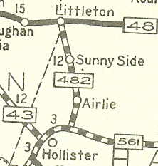
NC 4 was born about 1934 as a partial renumbering of NC 482. It originally ran just 4 miles from NC 561 to NC 48 (current SR 1312) Airlie.
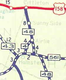
NC 4 was extended north to Littleton between 1951-53, replacing some of NC 48 which was rerouted northeast to Roanoke Rapids.
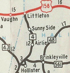
In 1985 or 1986, NC 4 was extended south: duplex with NC 561 to Brinkleyville, then a long duplex south with NC 48 to Gold Rock, then replacing part of Green 95 over to US 301. This brings us to the current routing of NC 4, shown on the scan below-right. | Comment: |
NC 4 is not really a route anyone would need to drive end to end.
When NC 903 was placed on the road from Littleton northward I'm not sure why this wouldn't have been an extension of NC 4. What's up with Battleboro? Over the years the town name has been removed from BGS's on US 301 and I think I-95 too. I noticed that Battleboro is not labeled on the 2006 Official Map either. Turns out that Battleboro was swallowed by Rocky Mount (SD Rhodes). NC 4 may have initially used Ferguson St instead of Mosby St entering Littleton. |
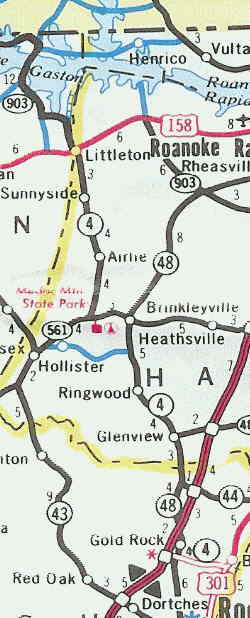
NC 4's current routing |
Last Update: 18 August 2006
Previous: N.C. 3 |
Next: N.C. 5
Top | NCRoads.com
Home