< SC 214 | Home | SC 215 ALT | SC 216 >
|
|
|
| ROUTE LOG |
US 21, US 321: 0 - 0 I-20 (exit 68): 2.1 - 2.1 SC 269: 10.4 - 12.5 Fairfield-Richland Line: 2.1 - 14.6 SC 213 WB: 8.9 - 23.3 SC 213 EB: 3.2 - 26.5 SC 34: 8.2 - 34.7 Chester-Fairfield Line: 12.5 - 47.2 SC 72 EB, SC 121 NB: 2.6 - 49.4 Union-Chester Line: 1.2 - 50.6 SC 72 WB, SC 121 NB: 2.7 - 53.3 SC 49-215 CONN: 9.0 - 62.3 US 176 EB, SC 18: 3.2 - 65.5 SC 496: 1.4 - 66.9 SC 49 WB: 0.3 - 67.2 SC 49 EB: 0.7 - 67.9 US 176 WB: 0.5 - 68.4 Spartanburg-Union Line: 11.5 - 79.9 SC 150: 3.5 - 83.4 SC 56 SB: 2.1 - 85.5 SC 56 NB: 1 - 86.5 US 221: 5.5 - 92 SC 295, SC 296: 4.1 - 96.1
|
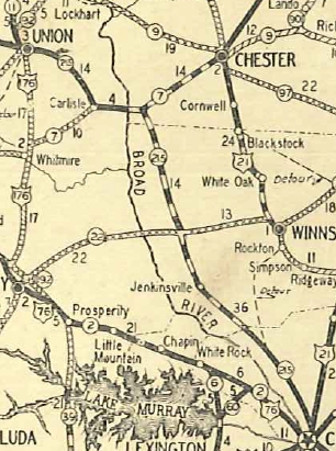
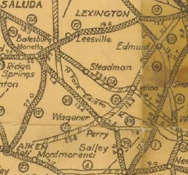
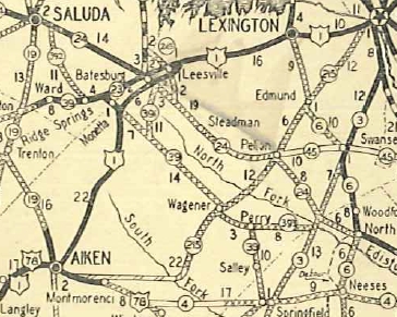
Creation: SC 215 appeared in 1928 replacing SC 121 from Aiken through Wagener, Pelion, Edmund to West Columbia; followed SC 2 into Columbia; replaced SC 161 through Jenkinsville and Carlisle before ending at US 176-SC 92 (current SC 18) Union. This is the only SC 215.
|
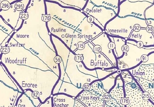
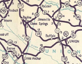
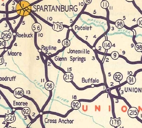
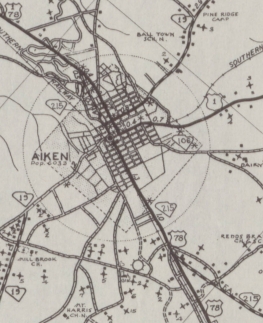
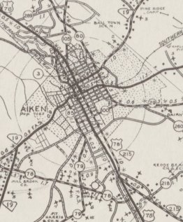
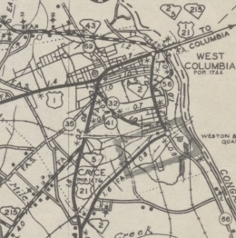
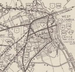
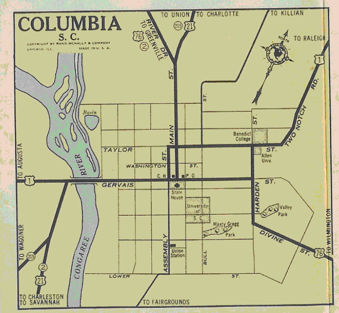
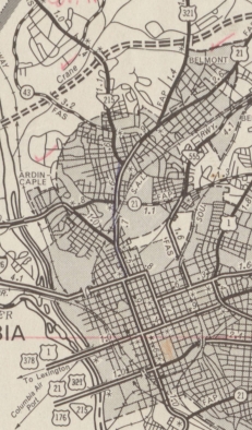
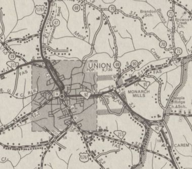
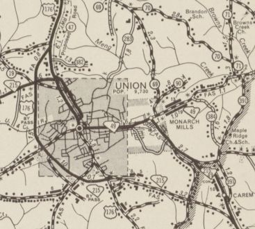
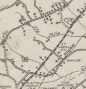
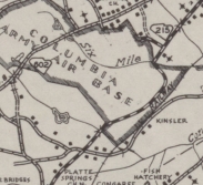
Adjustments: In Oct 1937 (SCDOT), SC 215 was extended west with US 78 into Aiken via Park Ave, then continued past SC 19 along Hayne Ave to end at US 1-78 just west of Aiken. Hayne Ave was almost certainly part of US 78 at some point but it is unclear when that stopped being true. About 1940, SC 215 was rerouted in Columbia to run from Gervais-Assembly-Taylor-Main to instead use Gervais-Main. In 1941 or 1942, SC 215 was rerouted around the east side of the Columbia Army Air Base. Between 1943-48, SC 215 was rerouted in Columbia from Gervais-Main to Gervais-Assembly-Elmwood-Main. In 1947, SC 215 was rerouted to head to Union without going to Monarch, replacing what was a primary route whose designation is not clear. The route to Monarch and Union became part of SC 92 (now this is the SC 49-215 CONN, SC 49, and S-44-6). In 1949, SC 215 was extended north with US 176 through Union, then replaced US 176 through Buffalo and ending at SC 56 Pauline.
In 1950, SC 215 was extended north replacing S-42-89 and S-42-49 to end at US 221 (now S-42-425) Roebuck. Between 1948-53, SC 215 was put back on its original routing through what was now Columbia's Airport. By 1952, SC 215 was moved along with US 78 from Park Ave to Richland Ave (replacing US 78 ALT) and ended at US 1. Hayne Ave and Park Ave became S-2-3.
In 1953, SC 215 was rerouted in West Columbia and Columbia to use Knox Abbott Dr across the Congaree River, then Blossom St east to Assembly north. The original route became US 1-21 CONN and US 1.
About 1956, SC 215 was placed on a new bypass west of Union, leaving behind US 176 Business (current SC 18).
In 1963, SC 215 was extended north to its current endpoint, replacing part of SC 295.
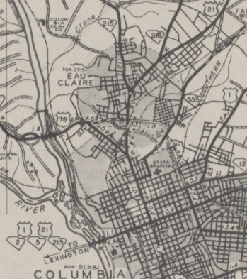
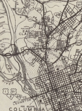
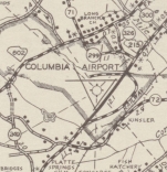
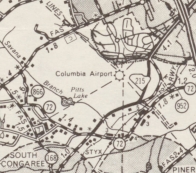
Between 1964-67, SC 215 was rerouted east around Columbia airport, using the southern half of the early 1940s rerouting before cutting westward sooner. The northern half of the 1940s loop is still visible on satellite but is not a road anymore.
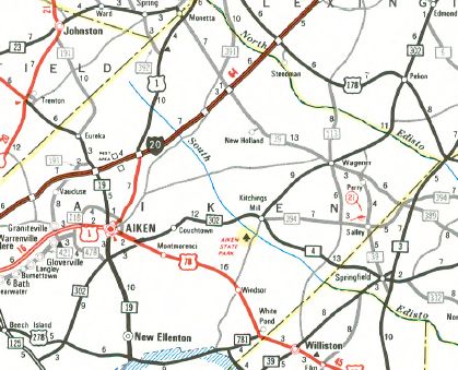
In 1971, SC 215 was removed from Old Monticello Rd loop a little south of SC 269. In 1976, SC 215 south was truncated to US 21-321 in Eau Claire, leaving behind US 78 out of Aiken; SC 302 from US 78 to Springdale; US 21-321 through Cayce and Columbia (some of this is now US 21-76 CONN and SC 48).
Improvements: Only Eau Claire to Columbia was paved upon creation in 1928. Cayce to Union was paved by April 1932. All of SC 215 in Aiken County plus the SC 6 multiplex was paved in 1937. The rest of SC 215 was paved in 1939. The US 21-321 multiplpex was 4-laned by 1958. SC 215 from US 21-176-321 southwest to the airport was 4-laned in 1962. SC 215 was multilaned on its US 78 duplex in 1963. SC 215 was 4-laned from US 21-321 to I-20 in 1967, and this was extended a couple miles north between 1968-69, and a couple miles further north in 1973. SC 215 was 4-laned on the Union bypass by 1987, although no Official Map has ever shown this. Comment: SC 215 makes a pretty decent backdoor route from Columbia to Union - not many towns and the route is not winding. Why SC 215 was assigned from Aiken to Union in the first place makes no sense, since SC 19-US 176 covered the same territory in many fewer miles. There was a SC 215 overhead posting at Blossom-Assembly for a number of years past the truncation of SC 215. | |||||||||||||||||||||||||||||


Previous: SC 214 |
Next: SC 215 ALT | SC 216
Top | South Carolina Hwy Index
Home
Page last modified 14 August 2015