 |
From:  Abbeville (Abbeville County) Abbeville (Abbeville County)
To:  Greenville (Greenville County). Greenville (Greenville County).
Total Length: 54.3 miles
|
|
|
|
|
ROUTE LOG
SC 72: 0 - 0
SC 203: 0.4 - 0.4
SC 71: 0.2 - 0.6
SC 201: 3.4 - 4
SC 185 EB: 6 - 10
SC 184 EB: 2.6 - 12.6
SC 184 WB: 0.4 - 13
SC 185 WB: 3.6 - 16.6
Anderson-Abbeville Line: 2.3 - 18.9
SC 252, SC 284: 3.4 - 22.3
US 76 WB, US 178 WB: 6.2 - 28.5
US 76 EB, US 178 EB: 0.1 - 28.6
SC 247: 0.1 - 28.7
US 29 CONN: 7.1 - 35.8
SC 8: 2.5 - 38.3
Greenville-Anderson Line: 0.9 - 39.2
SC 86: 3.8 - 43
I-85 (exit 43): 6.5 - 49.5
US 25: 0.6 - 50.1
US 29: 2.9 - 53
SC 124: 1 - 54
US 123: 0.3 - 54.3
|
|
Creation: An original state highway. In 1922 SC 20 ran from SC 8 (jct of Green St and Guess St) Greenville south along Allen St and Old Piedmont Hwy to Piedmont, Williamston, Belton, then along today's US 178 to Honea Path and Donalds, then today's SC 184 to Due West, then south to Abbeville, then along mostly today's SC 28 (using S-1-1 to leave Abbeville) to McCormick, and Clarks Hill before crossing into Georgia heading for Augusta, for a distance of about 107 miles.
Adjustments: Between 1924-25, SC 20 was extended north on Green St. to SC 2-8 Pendleton St. (current SC 124), replacing a piece of SC 8.
In 1935, SC 20 north was truncated to US 29 (current US 29-SC 20 CONN) S. Williamston. The route from there to Greenville became part of US 29, though today it is mostly again SC 20.
About 1937, SC 20 south was truncated to Abbeville, replaced by SC 28.
In 1956, SC 20 was rerouted between Due West and Belton to its current routing. This replaced SC 257 and some of SC 284. The old route became part of SC 184 and the US 178 piece remained so. Also, SC 20 was re-extended north replacing US 29 through Williamston and Piedmont, ending at a rerouted US 29 south of Greenville.
Between 1960-63, SC 20 was extended north along Grove Ave to end at US 25 (unnumbered now) Augusta Rd. This replaced US 29 Business.
Between 1998-2000, SC 20 was extended north to US 123, replacing part of US 25 Business.
Improvements: SC 20 was paved only from Greenville south a few miles by 1928.
In 1929 or 1930, SC 20 was paved from Greenville to Williamston and from Belton to Honea Path.
In 1931, SC 20 was paved from Honea Path down to Abbeville.
In 1933, SC 20 was paved from Modoc to the Georgia Line.
In 1934, SC 20 was paved everywhere except Williamston to Belton and McCormick to Plum Branch.
In 1935, McCormick to Plum Branch was paved.
In 1936, SC 20 became fully paved.
SC 20's northernmost 2 miles were multilaned by 1974.
When SC 20 was extended over old US 25 Business in Greenville, that was 4-laned as well.
Comment: SC 20 serves some rural, small town areas between Abbeville and Greenville, including Due West, home of Erskine College.
|
| SC
21 not currently assigned |
|
|
|
|
| Previous SC 21's: |
|
SC 21: An original state highway, running from the Georgia State Line at North Augusta through Edgefield, Greenwood, Greenville, and Travelers Rest before exiting into North Carolina at Caesars Head.
SC 21 followed both the Dixie Highway and the Boone Trail in South Carolina.
In 1925 or 1926, the segment from Travelers Rest to NC was renumbered as SC 211 (today's US 276), while SC 21 was instead sent north to enter the Tarheel state near Tuxedo (replacing SC 29).
In 1928, SC 21 was dropped in favor of US 25.
Today, SC 21 uses: US 25 Business through N. Augusta, US 25 to Greenwood, US 25 Business through Greenwood, US 178 to Hodges, SC 254 to Cokesbury, US 25 to Ware Shoals, US 25 Business through Ware Shoals, US 25 to Donaldson, SC 291 to I-85, Augusta Rd to Main St to Buncombe Rd through Greenville, US 276 to Travelers Rest, Old Buncombe Hwy to US 25, US 25 to just past today's SC 11, then S-23-969 to the North Carolina Line.
|
 |
From:  (Horry County) (Horry County)
To:  Briarcliffe (Horry County). Briarcliffe (Horry County).
Total Length: 4.9 miles
|
|
|
|
|
ROUTE LOG
US 501: 0 - 0
SC 319: 5 - 5
US 701: 3 - 8
SC 905: 11 - 19
SC 90: 4 - 23
SC 31: 4 - 27
US 17: 2 - 29
|
|
Creation: Appeared as a dotted line by 2000. Shown as opened new freeway from SC 905 to US 17 on the 2001 Official Map. This is the 2nd SC 22.
Adjustments: SC 22 was fully open by 2002.
Improvements: Fully paved upon designation; 6-lane freeway.
Comment: SC 22 serves as a high-speed alternative to get from the Marion area to Myrtle Beach, avoiding Conway. Best suited for northern Grand Strand destinations.
SC 22 is potentially slated to become I-73 at some point in the far future.
When SC 22 first opened at US 17, there were error US 90 shields (thanks Gribblenation) on the BGS's, an extremely rare error in South Carolina. Adam Prince reports when SC 22 was opened all the way to US 501, the "90" was peeled away and the "501" put in the shield.
|
| Previous SC 22's: |
|
SC 22 #1: An original state route. In 1922 it ran from SC 7-10-21 (current US 25-178/SC 72 Bus) Greenwood east to Ninety Six then to SC 2-19 (current US 76 Bus) Newberry.
In 1923, SC 22 was extended east as new routing to SC 16 (current US 321 Bus) Winnsboro.
In 1925 or 1926, SC 22 was extended east again as new routing to SC 97 (current S-12-20?) Great Falls.
In 1951 or 1952, SC 22 was replaced by SC 34 from Greenwood to Winnsboro and SC 200 from Winnsboro to Great Falls.
|
 |
From:   Modoc (McCormick County) Modoc (McCormick County)
To:  Leesville-Batesburg (Lexington County). Leesville-Batesburg (Lexington County).
Total Length: 47.6 miles
|
|
|
|
|
ROUTE LOG
US 221, SC 28: 0 - 0
Edgefield-McCormick Line: 1.4 - 1.4
SC 230: 8.3 - 9.7
US 25 NB: 9.1 - 18.8
US 25 SB: 0.5 - 19.3
SC 430: 1.9 - 21.2
SC 121: 5.8 - 27
Saluda-Edgefield Line: 1.8 - 28.8
SC 193: 2.5 - 31.3
SC 39 NB: 3.5 - 34.8
SC 392: 0.8 - 35.6
SC 39 SB: 2.9 - 38.5
Lexington-Saluda Line: 5 - 43.5
US 178 WB: 0.6 - 44.1
US 178 EB, SC 391: 0.1 - 44.2
SC 245: 2 - 46.2
US 1: 1.4 - 47.6
|
|
Creation: SC 23 was created about 1929, running from SC 39 Moneta to US 1 Batesburg. This may have been previously part of original SC 12. This is the 2nd SC 23.
Adjustments: In 1936, SC 23 was extended west to its current end in Modoc, replacing part of SC 39.
Improvements: SC 23's initial routing was paved upon inception. The extension west was paved to Edgefield upon designation.
The remainder of SC 23 was paved in 1939.
SC 23 has no multilane sections.
Comment: SC 23 runs parallel to US 1 at a close distance for a few miles, sort of a more business district routing through Batesburg-Leesville.
|
| Previous SC 23's: |
|
SC 23 #1: An original state route. Ran from SC 3 (current US 76-301 split) Pee Dee northeast through Latta and Dillon before entering North Carolina near Rowland, NC as NC 23.
In 1927, US 217 was assigned to the entirety of SC 23, thus in 1928 SC 23 was decommissioned. Today it is now part of US 301.
|
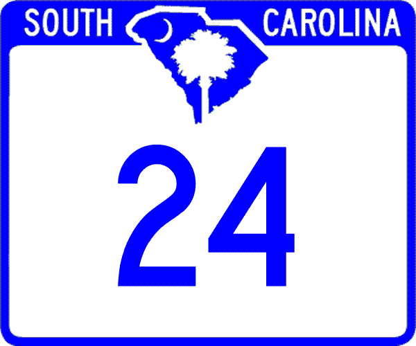 |
From:  Westminster (Oconee County) Westminster (Oconee County)
To: BUS Anderson (Anderson County).
Total Length: 29.4 miles
|
|
|
|
|
ROUTE LOG
US 76, US 123: 0 - 0
SC 11: 3.5 - 3.5
SC 182: 1.6 - 5.1
SC 59 SB: 2.1 - 7.2
SC 59 NB: 0.3 - 7.5
Anderson-Oconee Line: 5.6 - 13.1
I-85 (exit 11), SC 243: 4.5 - 17.6
SC 187 NB: 2.6 - 20.2
SC 187 SB: 2.7 - 22.9
SC 28: 4.5 - 27.4
US 29 Bus, US 76, US 178, SC 81: 1.9 - 29.3
SC 28 Bus: 0.1 - 29.4
|
|
Creation: Appeared in 1938 as a renumbering of SC 18. Ran more or less the way it does today. This is the 2nd SC 24.
Adjustments: Between 1962-64, SC 24's eastern end changed from Market and Main to its current Whitier and Main, coinciding with the elimination of SC 80.
Improvements: SC 24 was fully paved upon designation.
SC 24 was 4-laned between SC 187 and SC 28 in 2005.
Comment: SC 24 is actually shorter from Westminster to Anderson than US 76 and passes through less towns and slowdowns.
SC 24 (EB at SC 28) had the newest looking shield using the S. CAROLINA inside the square I'd ever seen in the late 1980s.
|
| Previous SC 24's: |
|
SC 24 #1: An original state route. In 1922 it ran from SC 7-10-21 (current US 25-178/SC 72 Bus) Ninety Six southeast to end at SC 12 (current SC 23) Hibernia.
In 1925 or 1926, SC 24 was extended southeast as new routing through Pelion to end at SC 6 (current US 321) North.
In 1928, SC 24 was extended south from North through Neeses, Norway, and Denmark before ending at SC 64 Olar.
In 1929, SC 24 was extended west as a duplex with US 25 to Hodges, then replaced SC 25 to Honea Path, replaced part of SC 15 through Belton, Anderson, and Pendleton before ending at SC 2 (current SC 93) Clemson. In the process, SC 24 was rerouted to avoid Ninety Six by duplexing south from Greenwood along US 25, then southeast directly to Saluda, replacing original SC 55. The old route from Ninety Six southward became SC 246.
In 1929 or 1930, SC 24 was rerouted at North to head east to Orangeburg (replacing SC 6) and duplexed with SC 2 down through Bowman and Rosinville before ending at US 78 in Dorchester County.
In 1931, SC 24 was extended west along SC 2 through Seneca and Walhalla before heading into Georgia above Mtn. Rest. This brought SC 24 to its finest hour at 231 miles.
In 1933, US 178 was assigned to all of SC 24 from Anderson all the way to US 78 in Dorchester County, eliminating SC 24 over a huge chunk of its routing. SC 24 remained duplexed with US 76 from Anderson to Seneca. Today it is still largely US 178, using its Business routes through Greenwood and Orangeburg.
The remaining part of SC 24 was renumbered as part of SC 28 in 1938. Today this is still SC 28 except in Pendleton (SC 187 and SC 88), Clemson (used today's SC 93), and Oconee County (used today's S-37-1; SC 130 and SC 59 through Seneca; S-37-60 much of the way to Walhalla).
SC 24 had long useless duplexes with SC 2 on both ends. The northwestern end did lose SC 2 for a brief time before becoming SC 28.
|
| SC
25 not currently assigned |
|
|
|
|
| Previous SC 25's: |
|
SC 25: An original state highway, running from
SC 20 (current US 178-SC 184 jct) Donalds southeast to SC 21 (current US 178-SC 246 jct) Hodges.
SC 25 was one of the shorter original routes (recall that 3-digit routes didn't come to South Carolina until 1923).
In 1929, SC 25 was renumbered as part of original SC 24, as US 25 ran very nearby. Today this is part of US 178.
|
| SC
26 not currently assigned |
|
|
|
|
| Previous SC 26's: |
|
SC 26 #1: An original state route. In 1922 it ran from SC 40 (current US 17) near Georgetown through Rhems, Kingstree, Manning, Sumter, Camden, Kershaw, and Lancaster before heading into North Carolina near Pineville, NC. The route continued on as NC 26 which became VA 26 to form an early MSR 26 from Georgetown, SC to Bluefield, WV.
In 1925 or 1926, SC 26 east was truncated to SC 41 (current US 52) Kingstree. The route that ran Kingstree-Rhems-Georgetown became not primary routing except the easternmost 2 miles became an extended SC 44. Today it is SC 527 from Kingstree to Boggy Swamp, S-45-38, S-45-218, unnumbered road across Pine Island Bay, S-45-74 to Old Morrisville, S-45-42 to Rhems, SC 51 to Outland, S-22-318 and S-22-71, then US 17A-521 into Georgetown.
In 1928, SC 26 was re-extended east from Kingstree, this time through Andrews and ending at SC 40 (current US 17) Georgetown. This replaced original SC 44.
In 1932, US 521 was assigned to the entirety of SC 26.
Thus, in 1933, SC 26 was decommissioned. Today it follows US 521 from Georgetown west; SC 377 north to Kingstree; SC 261 west to Manning; US 521 north to Sumter and mostly US 521 to Camden (brief detours at S-42-1342 Dalzell and S-42-2, S-28-2, and SC 261 near Boykin; US 521 and 521 Business through Kershaw and Lancaster, with US 521 on up tp the state line.
SC 26 #2: Appeared in 1935 as a renumbering of SC 52. Ran from US 21-SC 2-31 (current US 176-601 jct) St. Matthews north through Ft. Motte, Wateree, and Eastover before ending at US 76 near the Wateree River Bridge.
In 1938, SC 26 was rerouted to avoid Eastover, plus extended north to US 1 Lugoff. The zig-zag through Eastover then back across to US 76 near the Wateree River became SC 263 (below Eastover is now part of SC 764).
About 1948, SC 26 was given a bridge over the Congaree River, and also bypass of Ft. Motte. This left behind S-9-151.
In 1951 or 1952, SC 26 was renumbered as part of US 601.
|
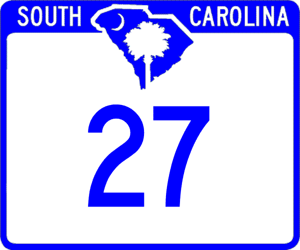 |
From:  Givhans (Dorchester County) Givhans (Dorchester County)
To:  Sandridge (Berkeley County). Sandridge (Berkeley County).
Total Length: 19.3 miles
|
|
|
|
|
ROUTE LOG
SC 61: 0 - 0
SC 173: 6.5 - 6.5
US 78 EB: 1.3 - 7.8
US 78 WB: 0.4 - 8.2
I-26 (exit 187): 1 - 9.2
Berkeley-Dorchester Line: 0 - 9.2
US 176: 10.1 - 19.3
|
|
Creation: Appeared about 1931, running from SC 65 (current SC 61) to US 78 east of Ridgeville. This is the 2nd SC 27.
Adjustments: In 1940, SC 27 was rerouted to head due north from Ridgeville, replacing SC 173. The old route east to US 78 became the new SC 173. SC 27 was also extended north to the Berkeley County Line.
In 1941 or 1942, SC 27 was extended north to SC 31 (current US 176).
Improvements: SC 27 was paved only from Ridgeville east to US 78 by 1938.
SC 27 was paved from SC 61 to US 78 in 1948.
SC 27 was paved from US 78 to US 176 in 1956.
SC 27 has no multilane segments.
Comment: SC 27s main function is to serve Ridgeville.
|
| Previous SC 27's: |
|
SC 27 #1: An original state route. In 1922, SC 27 ran from SC 21 (current US 25-SC 19 jct) Trenton south to Aiken, then east through Williston, Blackville, Denmark, Bamberg, and St. George before ending at SC 2 (current US 78-178 split).
In 1927, US 78 was assigned to everything east of Aiken.
In 1928, SC 27 was dropped from the US 78 routing and the piece between Aiken and Trenton became part of SC 19.
|
|
From:  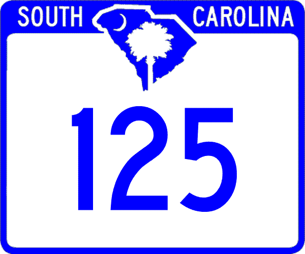 Beech Island (Aiken County) Beech Island (Aiken County)
To: Georgia State Line above Mountain Rest(Oconee County).
Total Length: 132.1 miles (SC + GA + NC 28 = 225 miles)
|
|
|
|
|
ROUTE LOG
US 278, SC 125: 0 - 0
GA STATE LINE: 1.5 - 1.5
GA STATE LINE: 0 - 1.5
McCormick Line: 0 - 0
US 221 SB: 7.1 - 8.6
SC 23: 4.7 - 13.3
SC 283: 9.5 - 22.8
US 221 NB, US 378: 4.8 - 27.6
SC 10: 1.7 - 29.6
SC 81: 5.4 - 35
Abbeville-McCormick Line: 7.5 - 42.5
SC 72: 6.9 - 49.4
SC 71: 2.9 - 52.3
SC 20: 0.5 - 52.8
SC 184 EB: 10.5 - 63.3
SC 284 WB: 0.4 - 63.7
SC 184 WB: 0.6 - 64.3
SC 284 EB: 1.2 - 65.5
Anderson-Abbeville Line: 1.3 - 66.8
SC 413: 2.8 - 69.6
SC 185: 5.2 - 74.8
SC 28 Bus: 4.2 - 79
US 29, SC 81: 0.1 - 79.1
US 29 Bus: 0.7 - 79.8
SC 24: 1.9 - 81.7
US 76 EB, SC 28 Bus: 4.3 - 86
I-85 (exit 19): 1.8 - 87.8
SC 187 SB: 5.7 - 93.5
SC 187 NB: 0.7 - 94.2
Pickens-Anderson Line: 2.3 - 96.5
SC 88: 1.8 - 98.3
SC 93: 0.5 - 98.8
US 123 NB: 0.7 - 99.5
SC 133: 0.3 - 99.8
Oconee-Pickens Line: 1 - 100.8
SC 93: 0.8 - 101.6
SC 130: 4.4 - 106
US 76 WB, US 123 SB, SC 59: 2.4 - 108.4
SC 188: 1.2 - 109.6
SC 11: 4.6 - 114.2
SC 183 EB: 1.2 - 115.4
SC 183 WB: 0.1 - 115.5
SC 107: 8.2 - 123.7
GA STATE LINE: 8.4 - 132.1
|
|
Creation: An original state route. The 1922 Rand McNally shows it running from SC 1 (current US 278) Allendale northwest through Ellenton and Beech Island before entering Georgia, continuing as GA 52.
Adjustments: In 1928, SC 28 was extended southeast through Fairfax, Hampton, and Varnville to Yemassee (all replacing part of SC 1). Then SC 28 went to pocotaligo and then east to Gardens Corner and south to Beaufort, all replacing part of SC 30.
In 1935, SC 28 east was truncated to US 17-21 (current S-7-3) Yemassee. The route from Yemassee to Beaufort became an extended US 21.
In 1938, SC 28 was assigned to what is now the current SC 28 corridor replacing: SC 20 from Georgia to Abbeville; SC 18 from Abbeville to Anderson; SC 24 from Anderson to the Georgia line.
In 1940, SC 28 was extended southeast directly to US 21-SC 32 Gardens Corner. This was new primary routing.
In 1948, SC 28 east was truncated back to Yemassee, leaving behind S-7-21.
In 1951 or 1952, SC 28 was cutoff by the Savannah River Plant.
In 1953, SC 28 was rerouted to avoid the Savannah River Plant: Beech Island eastward replacing SC 781 to the current 781 west end, then south as new primary routing to Barnwell, then south back to Allendale, replacing part of SC 3. The old route became SC 125 Beech Island to SRP and SC 641 from Allendale west to the SRP on the other side. Today this is S-2-5 and SC 125. This brough SC 28 to its longest path at 222 miles.
In 1957 or 1958, SC 28 received a new north bypass of Seneca. The old route through town became SC 28 Business. Today it is SC 130 and SC 59.
Also in 1957 or 1958, SC 28 received its western bypass of Abbeville, leaving behind SC 28 Business. Today this is part of SC 72 and SC 201, plus either SC 20 or SC 20 CONN.
In 1959, SC 28 was straightened out from Seneca eastward, avoiding the Newry area. A small piece became part of SC 130, but mostly it became S-37-1.
In 1960 or 1961, SC 28 was given its western bypass of Anderson, leaving behind SC 28 Business.
In 1962 or 1963, SC 28 was rerouted around the east and north of Clemson as new routing. This left behind SC 93. Also in this timeframe, SC 28 was placed on a western bypass of Pendleton, leaving behind SC 28 Business (current SC 187 and SC 88 today).
In 1965, SC 28 east was truncated to Beech Island replaced by US 278 from Beech Island to Alameda, and all of today's SC 68.
In 1973, SC 28 was given a new routing between US 76-123 and Walhalla, leaving behind S-37-60 and P-3701 (this includes a little SC 188 today).
Improvements: SC 28 was paved from Yemasee to Gardens Corner in 1929 or 1930.
In 1931, SC 28 was paved from Gardens Corner to Beaufort and from Alameda to Fairfax.
In 1932, SC 28 became fully paved from Augusta to Beaufort.
All parts of SC 28 north of Augusta were paved upon designation as SC 28.
The brief extension of SC 28 from Yemassee to Gardens Corner was not paved while part of SC 28.
SC 28's first multilane segment was between Seneca and Clemson, in 1959.
In 1962 or 1963, SC 28 was 4-laned from Clemson to I-85.
Between 1965-67, SC 28 was 4-laned from I-85 to its northern bypass.
In 1973, SC 28 was 4-laned on the Seneca Bypass, and from Seneca to Walhalla.
In 1974, SC 28 was 4-laned on the Anderson Bypass from old SC 80 to Camellia Dr.
In 1975, SC 28 was 4-laned from Camellia Dr. north to the railroad overpass.
In 1997, SC 28 was 4-laned from old SC 80 (Market St.) south to the end of the Anderson Bypass.
Comment: SC 28 serves as the main route up the western side of South Carolina, connecting Augusta to McCormick, Abbeville, Anderson, Clemson, Seneca, and Walhalla.
SC 28 passes through a large piece of Sumter National Forest and south of SC 81 is also part of the Savannah River National Scenic Highway.
SC 28 enters SC twice and Georgia twice. It also comes within a mile of entering Tennessee.
|
|
BUSINESS |
From: (Anderson County)
To: (Anderson County).
Total Length: 6.8 miles
|
|
|
|
|
ROUTE LOG
SC 28: 0 - 0
US 29: 0.4 - 0.4
US 76, US 178: 1.5 - 1.9
US 29 Bus, SC 81: 0.6 - 2.5
US 76 EB, US 178 EB: 2.3 - 4.8
US 178 WB: 1.2 - 6
US 76 WB, SC 28: 0.8 - 6.8
|
|
Creation: Appeared in 1960 or 1961 when SC 28 was given a western bypass of Anderson. This was of course mainline SC 28 prior.
Adjustments: None
Improvements: Fully paved upon designation; between 1965-67 SC 28 business was 4-laned from the northern end of the bypass south to just south of where US 76-178 crosses over south of downtown.
Comment: Uses Main St. through Anderson.
SC 28 Business was once the original SC 18.
|
|
| SC
28 Business Renumbered |
|
|
|
|
| Previous SC 28 Business: |
|
SC 28 Business: Appeared in 1957 or 1958 as Seneca was bypassed to the north. This route had been part of SC 2 originally. Used North 1st St.
SC 28 Business was renumbered as part of SC 59 and SC 130 in 2000 (AASHTO documents).
This SC 28 Business was totally multiplexed with US 123 and US 76 Business routes.
|
| SC
28 Business Renumbered |
|
|
|
|
| Previous SC 28 Business: |
|
SC 28 Business: Appeared in 1957 or 1958 as Abbeville was bypassed to the west. This route had been part of SC 18 and SC 20 originally. Used Main St and Vienna St.
Maps have implied a SC 28 Business has always been here, but it was not posted as such in 1987-89. I have not been to Abbeville since then, so I do not know the status. It was partially posted as SC 203, though.
|
| SC
28 Business Renumbered |
|
|
|
|
| Previous SC 28 Business: |
|
SC 28 Business: Appeared in 1962 or 1963 as Pendleton was bypassed to the west. This route had been part of SC 2 originally. Used Mechanic St.
SC 28 Business was renumbered as part of SC 88 (north half) and SC 187 (south half) between 1988-2000 (DeLorme Atlas).
This SC 28 Business was not multiplexed with US US 76 Business to my knowledge.
|
| SC
29 not currently assigned |
|
|
|
|
| Previous SC 29's: |
|
SC 29: An original state highway, running from SC 21 (current US 276) Travelers Rest north to the North Carolina State Line near Tuxedo, NC. The route continued as NC 29.
In 1925 or 1926, SC 29 was renumbered as part of SC 21. Today, it is part of US 25 and S-23-969.
|
Last Update: 24 April 2006
Previous: SC 10 - 19 |
Next: SC 30 - 39
Top | South Carolina Hwy Index
Home
|