< SC 127 | Home | SC 128 ALT | SC 129 >
|
|
|
| ROUTE LOG |
SC 170: 0 - 0 US 21: 2.0 - 2.0
|
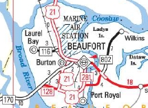
Creation: SC 128 appeared in 2012 as a renumbering of SC 802 running as it does now. This is the 2nd SC 128.
|
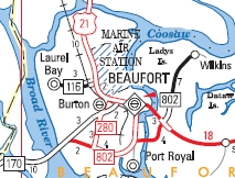
Adjustments: None Improvements: Paved upon designation; no multilane segments Comment: SC 128 is a cutoff from SC 170 to Parris island or Port Royal traffic. | Previous SC 128's:
1966 ROUTE LOG SC 462: 0 - 0 US 17 SB, SC 336: 5.6 - 5.6 US 17 NB: 0.2 - 5.8 SC 652: 4.3 - 10.1 SC 462 EB: 4.8 - 14.9 SC 462 WB: 0.8 - 15.7 SC 631: 4.9 - 20.6 Hampton-Jasper Line: 4.6 - 25.2 SC 28: 7.0 - 32.2 |
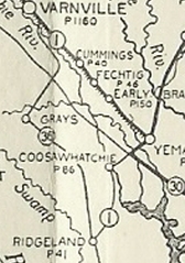
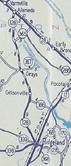
SC 128 #1: Appeared in 1940, running as new primary routing from SC 170 (now SC 462) Old House to Grahamville, then replaced SC 36 through Ridgeville and north to SC 28 (now SC 68) Alameda.
In 1966, SC 128 was renumbered as part of US 278. Today the part east of Ridgeland is now part of SC 336.
|
|||||||||||

Previous: SC 127 |
Next: SC 128 ALT | SC 129
Top | South Carolina Hwy Index
Home
Page last modified 25 September 2015