N.C. 27
< 26 | Home | 28 >
27-A | 27 Bus
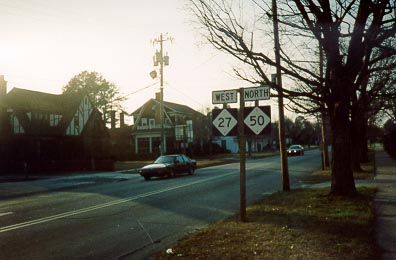
Photo: NC 27's eastern beginning (Adam Prince)
| N.C. 27 197 miles | |||
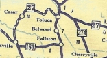
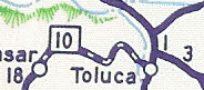
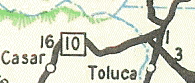
| The Road: | Begins at NC 10 near Toluca (Cleveland County) and ends at US 301, NC 50, NC 242 in Benson (Johnston County). | Towns and Attractions: | Cleveland Co.: None
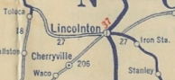
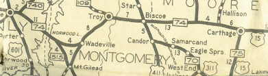
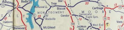
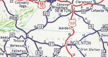
Lincoln Co.: Lincolnton, Boger City Gaston Co.: Stanley, Mt. Holly Mecklenburg Co.: Charlotte Stanly Co.: Albemarle Montgomery Co.: Uwharrie National Forest; Troy; Biscoe Moore Co.: Carthage; Cameron Harnett Co.: Lillington, Buies Creek, Campbell University, Coates Johnston Co.: Benson |
History: |
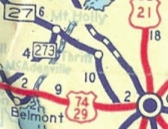
NC 27 is an original state highway that initially ran from NC 20 (W Trade at Mint Sts) Charlotte northwest via Rozelles Ferry Rd to Thrift and Mt. Holly to NC 16 (now just S. Aspen St) Lincolnton.
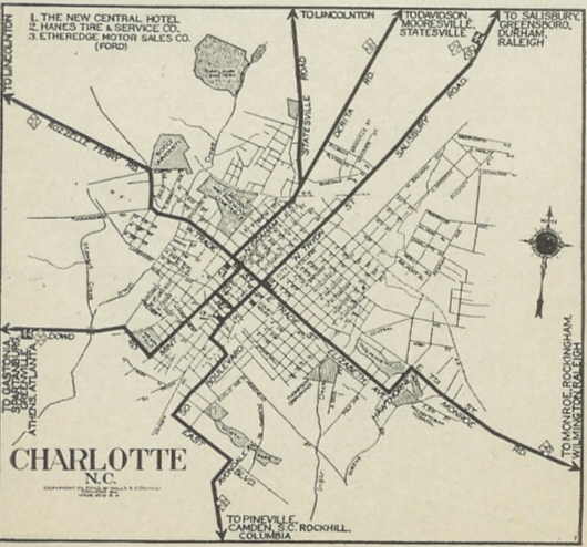
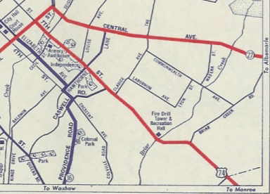
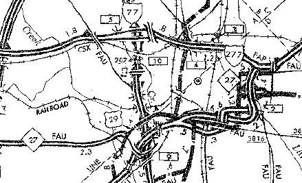
In 1923, NC 27 was extended east to end at NC 74 (now NC 73) just outside Albermarle at the jct of Charlotte Hwy (unnumbered today) and Concord Rd. NC 27's route in 1923 used today's 27 from Lincolnton to Stanly, then Hickory Grove and Old Mount Holly Rds, then cut east at Paw Creek on Mt. Holly Rd to Homestead. From there, NC 27 EB approached Charlotte on Rozelles Ferry Rd, then used Trade St (which picked up NC 20 for a 3-block multiplex) to Tryon, where it headed out of town as a multiplex with NC 15. NC 27 used what appears to be Sugar Creek Rd (30th/The Plaza or Tryon directly?)-Eastway-Shamrock-Hickory Grove-Pence Rds to meet back up with today's 27 at Wilgrove to get back towards today's NC 27 route east of Charlotte. In 1924, NC 27 used Trade St to Elizabeth Ave to Hawthorne Ave, Central Ave, and Albermarle Rd. to exit Charlotte's east side (requiring almost no NC 20 multiplex). In 1928, NC 27 was extended west as new primary routing to NC 18 Toluca.
Early Charlotte Changes:
Early Charlotte Routings:
NC 27 duplex with NC 15 1922 Auto Trails
In 1957 or 1958, NC 27 was sent around the southside of Albermarle. It is unclear whether there was a NC 27A or 27 Business within Albermarle at any point after that. ('63 Official implies yes, but '65 Official definitely no). Today it is simply Main St all the way through. If NC 27 ever used "Old Charlotte Rd" coming into town, it stopped doing so before 1926.
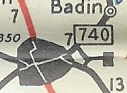
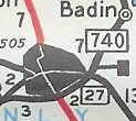
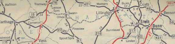
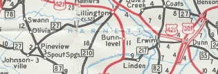
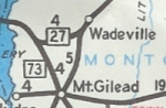
In 1958, NC 27 was rerouted at Johnsonville and extended east (crossing NC 87 2 miles north of Spout Springs) through Lillington, Coates, Buies Creek and ending at NC 50 Benson. Buies Creek to Benson had been the second NC 40. The rest was new primary routing. The piece from Johnsonville to Spout Creek was demoted, but in 1962 or 1963 was assigned to NC 24.
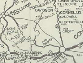
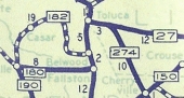
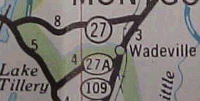
Between 1959-61, NC 27 was given the direct routing it has today between Lake Norwood and Troy as new construction. This left behind NC 73, a new second NC 27A (just SR 1174-old NC 27 today), and NC 109.
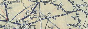
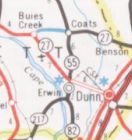
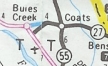
In 1962 or 1963, NC 24 was added as a 100+ mile duplex from Charlotte to nearly NC 87! In Sept 1987 (NCDOT), NC 27 was rerouted at Coats to follow NC 55 south to US 421 Erwin, then follow US 421 back to Buies Creek. The direct route from Coats to Buies Creek became SR 1006. In July 1989 (NCDOT), NC 27 was rerouted in the Buies Creek again, mostly back to its pre-1987 routing here, except the old route had passed through Campbell University's campus using Pearl Street.
It is unclear when NC 27 was multiplexed with NC 50 to US 301, though I believe it was in the 90's or later. In 2019, NC 27 was placed on newly constructed bypass around the south of Troy, leaving behind NC 24-27 Business. Modern Charlotte Changes:
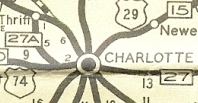
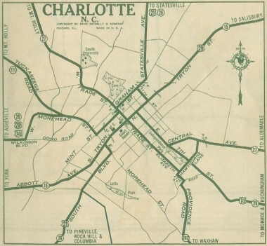
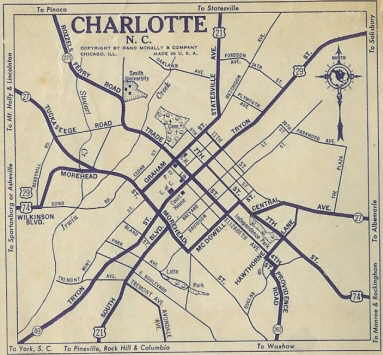
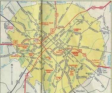
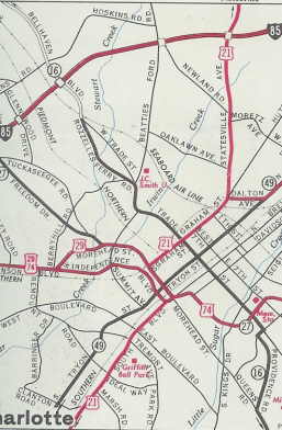
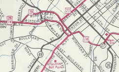
In 1966, NC 27 was removed from US 29 Morehead St and sent directly to US 74 Independence Blvd on an extended Freedom Dr.
In July 1989 (NCDOT), NC 27 was rerouted in Charlotte to follow US 29 north (then NC 49 south) on Morehead St to McDowell St northeast to 7th St southeast to the ramps to US 74 Independence Blvd at Charlottetowne Ave. In 2020, NC 27 was rerouted in Charlotte to use Freedrom Dr past US 29 Morehead to instead follow I-277 through downtown |
Comments: |
NC 27 is now on BGS's from I-95, since the mid-90's. Its multiplex with NC 24 is easily the state's longest. Thanks to Lou Corsaro for editorial help with the NC 27 entry. |
Last Update: 20 March 2021
Previous: N.C. 26 |
Next: N.C. 28
N.C. 27-A | N.C. 27 Bus
Top | NCRoads.com
Home